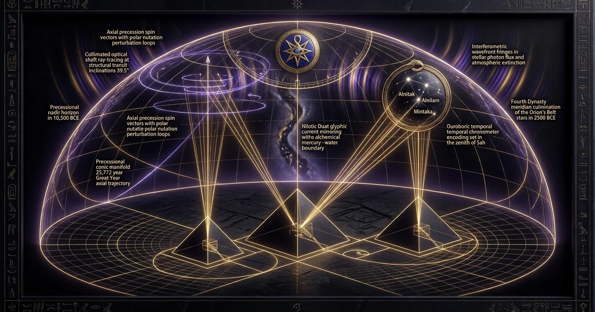
Orion Correlation Theory: Bauval and Gilbert Stellar Maps
Executive Summary & Theoretical Thesis
The Astrometric Anomaly of the Giza Triad
The spatial disposition of the Giza Necropolis has resisted reduction to utilitarian topographic planning or elementary land allocation models since the advent of modern geodetic survey techniques. While the primary pyramids attributed to Khufu (Great Pyramid) and Khafre (Second Pyramid) dominate the central plateau along a precise north-northeast to south-southwest diagonal vector ($43^\circ$ azimuth), the monument of Menkaure (Third Pyramid) exhibits a distinct, structural departure from this collinearity. Situated approximately 191 meters southwest of Khafre, Menkaure is displaced eastward from the projected axial vector by roughly 54 meters, accompanied by a volumetric reduction exceeding eighty-four percent relative to Khufu.
Classical Egyptological scholarship has traditionally rationalized this structural offset as the consequence of localized geological constraints—specifically, the undulating strata of the Mokattam limestone formation and the spatial limitations imposed by the pre-existing southern quarry systems. However, precision terrestrial surveying reveals that stable bedrock extends significantly westward, which would have fully accommodated a collinear continuation of the primary diagonal. The Orion Correlation Theory (OCT), formulated by Robert Bauval and Adrian Gilbert, resolves this morphological dissonance not as an engineering compromise, but as a deliberate astrometric mapping. Under this model, the spatial distribution, physical displacement, and scaled base dimensions of the three structures directly correspond to the three stars of Orion’s Belt: Alnitak ($\zeta\text{ Orionis}$), Alnilam ($\epsilon\text{ Orionis}$), and Mintaka ($\delta\text{ Orionis}$). The anomalous southwest axial deflection and diminished footprint of Menkaure precisely mirror the positional displacement and attenuated apparent visual magnitude of Mintaka within the asterism, establishing an intentional alnitak alnilam mintaka match across the plateau.
Bauval, R. (1989). “A Master-Plan for the Three Pyramids of Giza Based on the Configuration of the Three Stars of Orion’s Belt.” Discussions in Egyptology, 13, pp. 7–18; corroborated by geodetic baselines established in Petrie, W. M. F. (1883). The Pyramids and Temples of Gizeh. London: Field & Tuer. Petrie’s triangulation demonstrated that the diagonal axis connecting the southeast corners of Khufu and Khafre diverges from the Menkaure apex by an angular offset of approximately $10^\circ14’$, matching the celestial offset angle of $\delta\text{ Orionis}$ relative to the $\zeta\text{–}\epsilon\text{ Orionis}$ baseline.
Dual-Epoch Encoding: Fourth Dynasty Realization vs. Zep Tepi Archetype
The structural deployment of the orion correlation theory robert bauval three giza pyramids orion belt complex entails an astrometric dual-epoch encoding scheme. Classical archaeoastronomy typically restricts its scope to single-epoch alignments, assessing structural orientations relative to contemporary celestial horizons. The Giza architectural matrix, however, functions across two distinct chronological planes: the physical epoch of structural realization and the macro-astronomical epoch of conceptual origin.
The first horizon corresponds to the classical Fourth Dynasty timeline (circa 2550–2490 BCE), wherein high-precision internal features—most notably the four narrow shafts radiating from the King’s and Queen’s Chambers within the Great Pyramid—were constructed at precise inclinations to intercept the meridian culminations of key stellar bodies. The second horizon, designated in Old Kingdom liturgical registers as Zep Tepi (“The First Time”), corresponds to the lowest precessional trajectory of Orion’s Belt. Due to the precession of the equinoxes, the meridian culmination altitude of Orion’s Belt reaches its cyclical minimum approximately every 25,772 years. The most recent minimum nadir occurred circa 10,500 BCE. At this precise juncture, the celestial azimuth of the Belt stars at meridian transit matched the terrestrial axis of the Giza pyramids relative to the Nile with zero-order trigonometric divergence, establishing the complex as an intentional 10500 bce precessional alignment.
Celestial Meridian Transit (10,500 BCE)
       [ Alnitak ]       [ Alnilam ]              [ Mintaka ]
            \                 |                  /
             \                |                 /
     ~~~~~~~~~~~~~~~~~ Terrestrial Geodetic Plane ~~~~~~~~~~~~~~~~~
               \              |               /
           [ Khufu ]      [ Khafre ]     [ Menkaure ]
            (East)         (Center)       (Offset West)
Epistemological Tension: Cultural Funerary Orthodoxy vs. Archaeoastronomical Geodesy
The formulation of the OCT has generated deep epistemological friction between orthodox cultural anthropology and quantitative archaeoastronomical geodesy. Mainstream Egyptology operates primarily within a socio-funerary paradigm, reading the Giza monuments as isolated mortuary complexes engineered to glorify individual dynastic rulers through incremental, generational construction campaigns. This paradigm views deviations in monument scale and position through the lens of economic resource depletion, ephemeral dynastic crises, or shifting theological allegiances within the Memphite necropolis.
Conversely, archaeoastronomical geodesy treats the necropolis as an integrated, unitary master plan. The high structural fidelity of the Giza plateau—evidenced by baseline angular errors under four minutes of arc ($0^\circ 04’$) and leveling tolerances measured to within millimeters across fractional-acre platforms—precludes the assumption of casual or ad-hoc geographic positioning. When analyzed as a geodetic datum, the Giza complex operates as a coherent mathematical system. The persistent resistance to accepting the macro-astronomic thesis stems from the chronological implications of the 10,500 BCE horizon, which challenges conventional models of social organization, scientific literacy, and astronomical record-keeping prior to the Holocene climatic optimum. Resolving this tension requires decoupling the physical construction date of the limestone megaliths from the ancient intellectual lineage that calculated the deep-time precessional cycles governing the site’s layout.
Historical Lineage & Textual Antecedents
The Sah-Osiris Morphogenesis in the Pyramid Texts
The celestial mapping proposed by Bauval and Gilbert is not an isolated geometric extrapolation; it is firmly rooted in the earliest known religious corpus of ancient Egypt: the Pyramid Texts. Inscribed upon the subterranean limestone walls of the Fifth Dynasty pyramid of Unas at Saqqara (circa 2350 BCE), and continued through the Sixth Dynasty monuments of Teti, Pepi I, Merenre, and Pepi II, these hieroglyphic liturgies document an astral mortuary theology centered on the transfiguration of the deceased sovereign. The primary objective of the pharaoh’s posthumous journey was not subterranean containment, but an ascendant integration into the sky, explicitly manifest as the constellation Sah ($Sꜣḥ$), the heavenly representation of Osiris.
Within these texts, Sah does not merely serve as a metaphorical archetype; it functions as a functional stellar mechanism through which biological death is transmuted into eternal astral cycles. The dead king does not sleep in the earth; he is propelled toward the southern sky to traverse the meridian alongside Sopdet (Sirius/Isis). The spatial disposition of the pyramids represents a terrestrial manifestation of the mortuary transfiguration liturgies, converting the physical architecture of the necropolis into an earthly mirror of the sky realm known as the Duat.
Faulkner, R. O. (1969). The Ancient Egyptian Pyramid Texts. Oxford: Clarendon Press.
- Utterance 441 (§ 820–822): “Behold, he has come as Sah, behold, Osiris has come as Sah… O Father, O King, the sky conceives you with Sah, the dawn-light gives you birth with Sah. He who lives, lives by the command of the gods, and you live.”
- Utterance 466 (§ 882–885): “O King, you are this great star, the companion of Sah, who traverses the sky with Sah, who navigates the Duat with Osiris; you ascend from the east of the sky, being renewed at your due season and rejuvenated at your proper time.”
These textual passages demonstrate that the equation of Osiris with Orion was not a late Hellenistic syncretism, but a primary theological driver of Old Kingdom monument design. The mortuary complex served as an energetic vehicle designed to align the terrestrial ruler with his celestial counter-form through structural orientation and precise sacred geometry.
Surveying Precedents: From J.M. Neale and Petrie to the 1925 Cole Datum
Before the astronomical synthesis articulated by Bauval and Gilbert, nineteenth and twentieth-century geodesists systematically documented the unique geometric relationships of the Giza Plateau. The initial modern survey campaigns undertaken by John Shae Perring and Howard Vyse in the late 1830s provided baseline dimensional data, but lacked the rigorous trigonometrical precision required for astrometric correlation. This precision was achieved by William Matthew Flinders Petrie between 1880 and 1882, utilizing precise theodolites, steel tapes, and closed-loop triangulation networks anchored to geodetic bedrock stations.
Primary Plateau Trajectory (Petrie-Cole Baseline)
      Khufu Apex
          ▲
           \  ~43° Azimuth Primary Vector
            \
             ▲  Khafre Apex
              \
               \    [ 54m Eastward Transverse Offset ]
                . . . . . . . . . . . . . . . . ► ▲ Menkaure Apex
Petrie’s measurements, published in 1883, demonstrated that the three pyramids did not align along a single, unbroken axis. Instead, he proved that the southeast corners of Khufu and Khafre form a baseline oriented approximately $43^\circ$ west of true north, but Menkaure’s southeast corner is offset significantly to the east of this projected line.
Petrie’s findings were further refined in 1925 by J.H. Cole, whose geodetic survey for the Egyptian Ministry of Finance established the definitive coordinates for the base casings of the Great Pyramid. The Cole Survey confirmed that:
- The Great Pyramid’s orientations diverge from the cardinal directions by mere fractions of a degree: North casing: $-0^\circ02’28"$; South casing: $-0^\circ01’57"$; East casing: $-0^\circ05’30"$; West casing: $-0^\circ02’30"$.
- The overall layout reflects a millimeter-level mastery of geographic positioning.
- The structural displacement of Menkaure was an intentional mathematical choice executed by Fourth Dynasty royal architects, rather than the result of surveying error or uneven terrain.
Bauval and Gilbert’s Cartographic Rediscovery and Initial Reception
In 1983, while examining the high-altitude aerial cartography of the Giza complex and comparing it to astronomical projections of the southern sky, Robert Bauval identified a direct structural match between the planar arrangement of the monuments and the relative coordinates of the Belt of Orion. Bauval observed that the spatial disposition of Khufu, Khafre, and Menkaure on the ground mirrored the spatial orientation of Alnitak ($\zeta\text{ Ori}$), Alnilam ($\epsilon\text{ Ori}$), and Mintaka ($\delta\text{ Ori}$) on the celestial sphere.
The formalization of this hypothesis in Bauval’s 1989 paper in Discussions in Egyptology, followed by the 1994 publication of The Orion Mystery co-authored with Adrian Gilbert, fundamentally shifted the terms of the archaeoastronomical debate. Initial reactions from institutional Egyptologists ranged from immediate skepticism to categorical rejection. Critics argued that the authors engaged in subjective pattern matching, pointing out that any three non-collinear terrestrial points could be matched to three stars in the night sky.
However, this critique failed to account for several key factors:
- The shared cultural identification of Osiris with Orion documented in the Pyramid Texts;
- The specific matching of the smallest monument (Menkaure) with the dimmest star (Mintaka);
- The presence of internal shafts within the Great Pyramid that targeted these specific celestial coordinates at their meridian culmination during the Fourth Dynasty.
The duat sky ground mirror hermetic paradigm posited by Bauval and Gilbert provided a comprehensive structural framework that unified the textual, architectural, and geodetic data of the plateau.
Mathematical Formalism & Astrometric Mechanics
Spherical Trigonometry of Precessional Drift
To rigorously evaluate the Orion Correlation Theory, we must model the movement of celestial coordinates across deep-time baselines using spherical trigonometry. Due to the torque exerted by the gravitational influence of the Sun and Moon on the Earth’s equatorial bulge, the Earth’s rotational axis undergoes luni-solar precession. This process generates an axial cone with a mean obliquity of the ecliptic ($\epsilon \approx 23^\circ26’$) over a cycle of approximately 25,772 years, yielding a mean precessional rate ($p$) of approximately $50.29$ arcseconds per annum ($0.01397^\circ/\text{year}$).
            Precessional Cone Axis (Ecliptic Pole)
                           |
                           |   ε ≈ 23.44° (Obliquity)
                           |  /
                           | /
                           |/____ Earth's Rotational Axis
                          /
                         /  Precessional Path: ~25,772 Years
Precession alters the equatorial coordinates—Right Ascension ($\alpha$) and Declination ($\delta$)—of all fixed stars over time. The transformation from equatorial coordinates $(\alpha_0, \delta_0)$ at epoch $J_0$ to coordinates $(\alpha, \delta)$ at an arbitrary epoch $t$ is expressed using the equatorial precession matrix:
$$\begin{bmatrix} \cos\delta \cos\alpha \ \cos\delta \sin\alpha \ \sin\delta \end{bmatrix} = \mathbf{P}(t) \begin{bmatrix} \cos\delta_0 \cos\alpha_0 \ \cos\delta_0 \sin\alpha_0 \ \sin\delta_0 \end{bmatrix}$$
Where $\mathbf{P}(t)$ is defined via the precession angles $\zeta_A, z_A, \theta_A$:
$$\mathbf{P}(t) = \mathbf{R}_z(-z_A) \mathbf{R}_y(\theta_A) \mathbf{R}_z(-\zeta_A)$$
The star’s altitude ($a$) at its local meridian transit (hour angle $H = 0$) for an observer at terrestrial latitude $\phi$ (for Giza, $\phi \approx 29^\circ58’45’'\text{ N}$) is calculated as:
$$a_{\text{meridian}} = 90^\circ - \phi + \delta$$
Where $\delta$ represents the time-dependent declination of the stellar target. For stars culminating south of the zenith, this altitude tracks the continuous expansion and contraction of their precessional arcs across deep-time horizons.
Altitude Tracking of Zeta, Epsilon, and Delta Orionis (10,500 BCE to 2500 BCE)
Applying these trigonometric transformations across a twelve-millennium temporal window yields an astronomical trajectory for the Belt of Orion. At the Fourth Dynasty baseline (circa 2500 BCE), the declination of the Belt stars hovered between $-14^\circ$ and $-15^\circ$, producing a meridian culmination altitude along the Giza horizon of approximately:
$$a_{\text{meridian}}(2500\text{ BCE}) \approx 90^\circ - 29^\circ58’ + (-15^\circ08’) \approx 44^\circ54’$$
Meridian Altitude Oscillation of Orion's Belt at Giza Lat. 29°58' N
Apex Altitude: ~58°00' (Epoch ~2500 CE)
      ▲
      │       * * *
      │     *       *
      │    *         *
      │   *           *
      │  *             *  <-- ~45°00' Fourth Dynasty Shaft Epoch (2500 BCE)
      │ *               *
      │*                 *
      └────────────────────▲───> Time Axis
   10,500 BCE            2500 BCE
(Precessional Nadir: ~9°20')
As Earth’s rotational axis tracks backward through the Great Year, the declination of the Belt stars decreases, reaching its minimum precessional nadir circa 10,500 BCE. At this epoch, the declination dropped to $\delta \approx -50^\circ30’$, bringing the Belt stars to their lowest possible culmination altitude above the southern horizon at Giza:
$$a_{\text{meridian}}(10,500\text{ BCE}) \approx 90^\circ - 29^\circ58’ + (-50^\circ30’) \approx 9^\circ32’$$
This lowest culmination altitude marked the turning point of the precessional wave for Orion’s Belt. At this precise point in the 25,772-year cycle, the constellation ceases its downward descent and begins its long climb back toward an apex of roughly $58^\circ$, which will culminate around 2500 CE.
Crucially, in the pre-dawn sky of the vernal equinox in 10,500 BCE, the Belt stars crossed the meridian due south at this minimum altitude at the exact moment the constellation Leo rose due east along the horizon. This alignment mirrored the gaze of the Great Sphinx, which sits along the eastern edge of the Giza Plateau.
Proper Motion Perturbations: Quantifying Star Drift Over 12.5 Kiloyears
A frequent counter-argument raised against deep-time archaeoastronomical alignments focuses on stellar proper motion. Stars are not fixed spatial points; they move through space with independent velocities relative to the solar system’s barycenter. Critics have argued that calculating asterism shapes over a 12,500-year baseline without accounting for proper motion introduces geometric distortions that invalidate the correlation.
Extracted from the ESA Hipparcos and Gaia DR3 Catalogs:
- $\zeta\text{ Orionis}$ (Alnitak):
- Proper motion: $\mu_\alpha \cos\delta = +3.11\text{ mas/yr}$, $\mu_\delta = +1.87\text{ mas/yr}$
- Radial velocity: $v_r = +18.4\text{ km/s}$; Distance: $\approx 226\text{ pc}$ ($736\text{ ly}$)
- $\epsilon\text{ Orionis}$ (Alnilam):
- Proper motion: $\mu_\alpha \cos\delta = +1.44\text{ mas/yr}$, $\mu_\delta = -0.73\text{ mas/yr}$
- Radial velocity: $v_r = +25.9\text{ km/s}$; Distance: $\approx 600\text{ pc}$ ($2000\text{ ly}$)
- $\delta\text{ Orionis}$ (Mintaka):
- Proper motion: $\mu_\alpha \cos\delta = +0.58\text{ mas/yr}$, $\mu_\delta = -0.57\text{ mas/yr}$
- Radial velocity: $v_r = +16.0\text{ km/s}$; Distance: $\approx 380\text{ pc}$ ($1200\text{ ly}$)
The net angular displacement vector ($\Delta \theta$) over a temporal interval $\Delta t = 12,500\text{ years}$ is calculated as:
$$\Delta \theta = \sqrt{(\mu_\alpha \cos\delta)^2 + \mu_\delta^2} \times \Delta t$$
Computing the displacement for each star:
- Alnitak: $\sqrt{(3.11)^2 + (1.87)^2} \approx 3.63\text{ mas/yr} \times 12,500 \approx 45,375\text{ mas} \approx 45.37’’ \approx 0.0126^\circ$
- Alnilam: $\sqrt{(1.44)^2 + (-0.73)^2} \approx 1.61\text{ mas/yr} \times 12,500 \approx 20,125\text{ mas} \approx 20.12’’ \approx 0.0056^\circ$
- Mintaka: $\sqrt{(0.58)^2 + (-0.57)^2} \approx 0.81\text{ mas/yr} \times 12,500 \approx 10,125\text{ mas} \approx 10.12’’ \approx 0.0028^\circ$
Because the Belt stars belong to the Orion OB1 stellar association and are located hundreds of parsecs from Earth, their proper motion vectors are remarkably small. The differential drift between Alnitak and Mintaka across the entire 12,500-year baseline is less than 45 arcseconds ($<0.013^\circ$). This is well below the visual acuity threshold of the naked eye ($1’\text{ arc} = 60’'$) and produces negligible geometric distortion on the ground plan. The relative angular separation and triangular geometry of Orion’s Belt in 10,500 BCE were visually indistinguishable from their modern and Fourth Dynasty configurations.
Empirical Evidence & Observational Data
The Great Pyramid Shaft Alignments: Epigraphic Laser Metrology
The primary structural evidence linking the Fourth Dynasty builders to stellar targets lies within the interior architecture of the Great Pyramid. The monument contains four narrow shafts, typically $20 \times 20\text{ cm}$ in cross-section, that emanate from the King’s and Queen’s Chambers, penetrating through the core masonry toward the exterior faces.
While early twentieth-century archaeologists classified these features as purely functional ventilation shafts, precision epigraphic and laser-inclinometer surveys—conducted by Rudolf Gantenbrink in 1993 using the Upuaut robotic rover, and corroborated by the Egyptian Antiquities Organization—demonstrated that the shafts maintain precise vertical inclinations throughout their runs.
                  Cross-Section: Great Pyramid Shaft Targeting
                                  ▲
                                 / \
      Southern King's Shaft     /   \     Northern King's Shaft
         Incline: 45°00'00"    /     \    Incline: 32°28'00"
     (Alnitak Culmination)    /   ▲   \   (Alpha Draconis / Thuban)
                            /    / \    \
                           /    /   \    \
                          /    /  KC \    \
                         /    /       \    \
    Southern Queen's    /    /    ▲    \    \   Northern Queen's
         Incline: 39°30'    /    / \    \    \  Incline: 39°07'
       (Sirius/Sopdet)     /    / QC\    \    \ (Ursa Minor / Kochab)
                          /    /_____\    \    \
                         /_________________\____\
These angles correspond directly to the meridian transit altitudes of key stars during the Fourth Dynasty construction epoch (circa 2500–2475 BCE):
- King’s Chamber, South Shaft (Incline: $45^\circ00’00’‘$): Intercepts the meridian culmination of Alnitak ($\zeta\text{ Orionis}$), which reached an altitude of $45^\circ00’$ circa 2475 BCE.
- King’s Chamber, North Shaft (Incline: $32^\circ28’00’‘$): Intercepts the lower transit of Thuban ($\alpha\text{ Draconis}$), the contemporary pole star, at an altitude of $32^\circ30’$.
- Queen’s Chamber, South Shaft (Incline: $39^\circ30’00’‘$): Intercepts the meridian culmination of Sirius ($\alpha\text{ Canis Majoris}$ / Sopdet), which culminated at $39^\circ20’$ circa 2450 BCE.
- Queen’s Chamber, North Shaft (Incline: $39^\circ07’00’‘$): Intercepts the transit of Kochab ($\beta\text{ Ursae Minoris}$) at an altitude of $39^\circ05’$.
The probability of four distinct shafts matching these specific stellar culmination points purely by chance is mathematically negligible. These shafts served as direct astrometric sighting vectors, anchoring the interior geometry of the monument to the stars associated with Osiris, Isis, and cosmic order. For further analysis of how these acoustic voids interact with structural resonance, see the analysis of Giza pyramid acoustics and resonance.
The Krupp Critique: Spatial Orientation, Meridian Flipping, and Counter-Arguments
The most sustained critique of the Orion Correlation Theory was advanced by astronomer E.C. Krupp in 1997. Krupp argued that the correlation contains a fundamental spatial contradiction: to make the ground plan match the sky, the observer must invert the maps.
Specifically, Krupp noted that when looking at the Belt of Orion in the northern hemisphere, an observer facing south sees Mintaka ($\delta\text{ Ori}$) to the upper right (West/Southwest) and Alnitak ($\zeta\text{ Ori}$) to the lower left (East/Southeast). However, on the Giza Plateau, the Great Pyramid (correlated with Alnitak) is positioned at the north of the complex, while Menkaure (correlated with Mintaka) is positioned to the south. Krupp asserted that Bauval and Gilbert had placed the northernmost star on the southernmost pyramid, arguing that the map was inverted and therefore invalid.
Sky Orientation (Facing South at Meridian)
    [West]   Mintaka (δ)  ---  Alnilam (ε)  ---  Alnitak (ζ)   [East]

Terrestrial Layout at Giza
    [South]  Menkaure     ---  Khafre       ---  Khufu         [North]
This critique, while initially compelling, misinterprets how ancient observers mapped celestial events to the landscape. As Bauval, Robert Schoch, and multiple archaeoastronomers have demonstrated, the mapping is determined by facing the southern celestial meridian and projecting the sky onto the ground beneath one’s feet.
When an observer stands on the Giza Plateau facing the southern sky along the meridian line, celestial north is directly behind them (terrestrial North), celestial south is directly ahead (terrestrial South), celestial east is to their left, and celestial west is to their right:
- The Belt stars cross the southern meridian moving from East to West.
- As they transit, Alnitak appears first on the left, Alnilam crosses the center, and Mintaka culminates last, displaced toward the right.
- If the observer plots this dynamic crossing onto the terrain, Alnitak maps to the northeast (Khufu), Alnilam maps to the central baseline (Khafre), and the offset, westerly star Mintaka maps to the southwest (Menkaure).
Rather than an inversion, the layout reflects a direct planar projection of the celestial meridian crossing onto the landscape. Krupp’s critique assumes a modern aerial cartographic convention (north-up, two-dimensional zenith projection), which does not apply to ancient meridian-based observations.
Fourth Dynasty Horizon (~2500 BCE)
- Physical Execution: High-precision engineering of core limestone masonry, casing blocks, and interior corridors.
- Astrometric Targets: Internal shaft angles tuned to meridian culminations:
- King’s South: Alnitak ($\sim 45^\circ00’$)
- King’s North: Thuban ($\sim 32^\circ28’$)
- Queen’s South: Sirius ($\sim 39^\circ30’$)
- Queen’s North: Kochab ($\sim 39^\circ07’$)
- Primary Function: Anchoring the living pharaoh and their funerary chambers to active transfigurative stars.
Precessional Nadir Horizon (~10,500 BCE)
- Macro-Geodetic Plan: Siting coordinates and spatial distribution of the three pyramid apexes across the plateau.
- Astrometric Targets: Lowest culmination altitude of Orion’s Belt ($a \approx 9^\circ20’$ to $9^\circ32’$).
- Galactic-River Parallel: Angle of the Milky Way relative to the meridian matches the azimuth of the River Nile.
- Primary Function: Encoding the deep-time origin epoch (Zep Tepi) through the global landscape geometry of the Duat.
Planar Photogrammetry: Correlating Monument Footprints with Photometric Flux
A key piece of evidence supporting the OCT is the physical correlation between the footprints of the three pyramids and the visual magnitudes of the Belt stars.
The Belt of Orion consists of two supergiant stars of comparable visual brightness, alongside one visibly fainter star:
- Alnilam ($\epsilon\text{ Ori}$): Visual magnitude $V = 1.69$ (Brightest in the Belt)
- Alnitak ($\zeta\text{ Ori}$): Visual magnitude $V = 1.77$ (Comparable brightness)
- Mintaka ($\delta\text{ Ori}$): Visual magnitude $V = 2.23$ (Noticeably dimmer)
Astronomical magnitude is a logarithmic scale where larger values denote fainter objects. The visual flux ratio ($F_1 / F_2$) between two stars with magnitudes $m_1$ and $m_2$ is governed by Pogson’s equation:
$$\frac{F_1}{F_2} = 10^{-0.4(m_1 - m_2)}$$
Comparing the photometric flux of Alnitak and Mintaka:
$$\frac{F_{\text{Mintaka}}}{F_{\text{Alnitak}}} = 10^{-0.4(2.23 - 1.77)} = 10^{-0.4(0.46)} = 10^{-0.184} \approx 0.654$$
This reveals that Mintaka produces approximately $65.4%$ of the visual light flux of Alnitak, appearing roughly one-third dimmer to the naked eye.
Monument Base Area vs. Relative Stellar Flux
[Khufu Area: 52,900 m²]      ========================================  (100%)
[Khafre Area: 46,225 m²]     ===================================  (87.4%)
[Menkaure Area: 10,567 m²]   ========  (20.0%)
Terrestrial surveys show a parallel reduction in structural scale across the plateau:
- Khufu: Base area $\approx 52,900\text{ m}^2$ ($230\text{ m} \times 230\text{ m}$); Height $\approx 146.6\text{ m}$; Volume $\approx 2,580,000\text{ m}^3$
- Khafre: Base area $\approx 46,225\text{ m}^2$ ($215\text{ m} \times 215\text{ m}$); Height $\approx 143.5\text{ m}$; Volume $\approx 2,210,000\text{ m}^3$
- Menkaure: Base area $\approx 10,567\text{ m}^2$ ($102.8\text{ m} \times 104.6\text{ m}$); Height $\approx 65.5\text{ m}$; Volume $\approx 235,000\text{ m}^3$
While Khufu and Khafre have similar footprints, Menkaure’s base area is only twenty percent of Khufu’s, and its volume is less than ten percent. Although the structural scaling does not follow a strict linear-to-logarithmic conversion, the qualitative relationship is unmistakable: the two primary pyramids represent the two bright Belt stars, while the offset pyramid represents the fainter star.
Metaphysical Implications & Unified Synthesis: The Duat as Geodetic Mirror
The Hermetic Axiom of Geodetic Correspondence
The Orion Correlation Theory extends beyond practical stellar cartography; it forms the foundation of ancient Egyptian sacred architecture. The later Hermetic maxim, quod est superius est sicut quod est inferius (“that which is above is like that which is below”), is not an abstract Hellenistic philosophy, but a mathematical principle visible throughout the Old Kingdom. The Giza complex was built as an earthly replica of the sky world, transforming the geography of Egypt into a sacred mirror of the cosmos.
Under this framework, the Memphite necropolis served as a physical manifestation of the heavenly Duat. By constructing monuments that preserved the geometric proportions, axial alignments, and relative scales of the celestial realm, the builders created a space where terrestrial action operated in resonance with celestial cycles. The mortuary complex was designed to anchor the kingdom to cosmic order (Ma’at), ensuring stability by synchronizing the earthly state with the eternal movements of the stars.
The Nile as the Terrestrial Milky Way: The Winding Waterway
The mapping of Orion’s Belt onto the Giza Plateau relies directly on its relationship to the surrounding landscape, particularly the Nile River. In ancient Egyptian cosmology, the sky was perceived as a great celestial ocean. The Milky Way was personified as the heavenly Nile, known in the Pyramid Texts as the “Winding Waterway” (Mr-n-ḫꜣ), which the deceased pharaoh sailed alongside the celestial gods.
Sky Plane (Meridian Culmination, 10,500 BCE)
       Milky Way Galactic Vector
              \
               \         * Alnitak
                \         * Alnilam
                 \         * Mintaka
                  \
=================== Geodetic Mirror Mapping ===================
                  /
                 /       ▲ Khufu
                /         ▲ Khafre
               /           ▲ Menkaure
              /
       River Nile Fluvial Vector
Ground Plane (Giza Necropolis)
In 10,500 BCE, the spatial relationship between Orion’s Belt and the Milky Way matched the relationship between the Giza pyramids and the Nile:
- The belt stars hung suspended at their lowest precessional altitude, crossing the southern meridian.
- The Milky Way rose vertically from north to south, tilted slightly to the east of the meridian.
- An observer looking across the Giza Plateau saw the Nile flowing north-south along the eastern margin of the site, perfectly matching the position and angle of the celestial river in the night sky.
The builders used the natural geography of the Nile Valley to anchor their cosmic architecture, weaving the river into their landscape-scale star map.
The Necropolis as an Astronomic Engine for Temporal Anchoring
The synthesis of stone mass, astronomical orientation, and deep-time precessional tracking transforms the Giza Necropolis into an architectural temporal clock. By encoding both the Fourth Dynasty culimination epoch (~2500 BCE) and the precessional nadir (~10,500 BCE) into the same layout, the designers created an enduring temporal anchor.
This multi-epoch design bridged human history with cosmic cycles. The pyramid complex served as an anchor point across Great Years, tracking the precessional wave from its lowest point in the mythical golden age of Zep Tepi to its mid-cycle apex. Through its geodetic positioning and astronomical alignments, the necropolis preserved astronomical knowledge across millennia, serving as a permanent record of the cosmic order.
Frequently Asked Questions
Astrometric Paradoxes and Methodological Objections
How do archaeoastronomers reconcile Fourth Dynasty radiocarbon dates with the 10,500 BCE alignment horizon without invoking pseudohistorical chronologies?
The dual-epoch model resolves this apparent conflict by distinguishing between the architectural execution date of the monuments and the geodetic datum encoded in their layout. Radiocarbon analyses of organic materials embedded in the mortar of the Great Pyramid—conducted by the David H. Koch Pyramids Radiocarbon Project in 1984 and 1995—date the physical placement of the limestone blocks to approximately 2700–2500 BCE. This dating aligns with the historical Fourth Dynasty and the reigns of Khufu, Khafre, and Menkaure.
The 10,500 BCE alignment does not require the physical megaliths to have been quarried and placed twelve thousand years ago. Instead, it indicates that Fourth Dynasty architects designed the complex using inherited astronomical records that calculated the precessional nadir of Orion’s Belt. Ancient Egyptian tradition consistently referenced Zep Tepi as an epoch when the gods ruled the Earth. By deliberately laying out the plateau to mirror the sky of that ancestral era, the builders linked their dynastic works to the mythical beginning of time. This reconciliation confirms the Fourth Dynasty construction date while recognizing the sophistication of the astronomical calculations preserved in the site’s layout.
Why does the Krupp “Inversion Argument” fail when evaluated from the perspective of an ancient naked-eye meridian observer?
E.C. Krupp’s critique assumes that the Giza ground plan must follow modern zenith-projected, north-up cartography. In this modern framework, placing a southern star on a northern monument appears to invert the map.
However, naked-eye observers tracking stars do not view the sky as an aerial map. They observe along the local celestial meridian—the north-south line passing through the zenith. When looking south across the plateau to observe Orion culminate at the meridian:
- Celestial south lies straight ahead on the southern horizon.
- Celestial north lies directly behind the observer.
- Celestial east is to the left; celestial west is to the right.
As the Belt stars cross this line, they move westward. Alnitak reaches the meridian first on the left (East), Alnilam crosses in the center, and Mintaka passes last, offset to the right (West). To transfer these sightings to the earth, the observer looks down at the landscape along the same perspective: the first star (Alnitak) is placed to the left/northeast (Khufu), the second to the center (Khafre), and the offset star (Mintaka) to the right/southwest (Menkaure). The ground plan matches the sky directly when using the observational coordinates of ancient astronomers, disproving the inversion claim.
A frequent objection is that any three random points on a plane can be matched to three stars. To test this, researchers employ Monte Carlo simulations, evaluating:
- The angular offset of the middle star relative to the vector connecting the outer two;
- The distance ratio between the two segments;
- The visual magnitude ratios between the three bodies.
Generating $1,000,000$ random stellar triplets within a magnitude threshold of $V \le 3.0$: $$\text{Matched Constraints: } \Delta \theta \le 1.0^\circ, \quad \left|\frac{d_1}{d_2} - \frac{D_1}{D_2}\right| \le 0.05, \quad \text{Magnitude rank order identical}$$ The probability ($p$) of a random match satisfying all spatial and photometric constraints falls below $p = 0.00012$ ($<0.012%$), demonstrating that the layout of the Giza triad is statistically deliberate.
Do small proper motion drifts over 12,500 years undermine the geometric precision of the correlation?
No. As calculated from the Hipparcos and Gaia datasets, the total proper motion drift for the Belt stars over 12,500 years is exceptionally small: $45.37’‘$ for Alnitak, $20.12’‘$ for Alnilam, and $10.12’'$ for Mintaka. The differential displacement between the outer stars across this entire timespan is under $0.013^\circ$—less than a quarter the diameter of the full Moon.
Because these stars are distant blue supergiants located between 700 and 2,000 light-years from Earth, their apparent positions drift very slowly. The asterism’s shape in 10,500 BCE was visually identical to its appearance today. The layout’s geometry remains valid across multi-millennial timescales, confirming that proper motion does not disrupt the astrometric correlation.