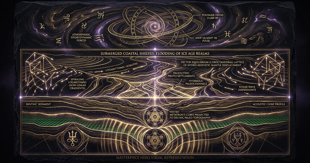
Submerged Coastal Shelves: Flooding of Ice Age Realms
Executive Summary & Theoretical Thesis: The Submerged Epistemology of Late Pleistocene Human Geography
The 120-Meter Eustatic Discontinuity as an Archaeological Horizon
The terminal Pleistocene epoch was punctuated by a radical reconfiguration of global paleogeography: the post-glacial marine transgression. Between approximately 19,000 and 6,000 years before present (BP), eustatic sea levels rose between 120 and 130 meters across the planet, submerging an estimated 25 million square kilometers of prime, low-gradient continental shelf. This expanse represents an area equivalent to the combined modern landmasses of North America and Europe. Conventional archaeological narratives, constructed almost entirely upon subaerial terrestrial excavations, view this transition through an inland-biased lens, interpreting the Upper Paleolithic-to-Mesolithic transition via data gathered from interior continental basements, high-altitude rock shelters, and inland river valleys.
By treating modern shorelines as persistent geographical baselines, mainstream prehistoric paradigms systematically mischaracterize the primary demographic and technological core of human development. During the Last Glacial Maximum (LGM), the vast coastal lowlands constituted optimal eco-refugia. These littoral zones offered high biomass yields, uninhibited migratory corridors along marine-estuarine interfaces, and access to marine protein regimes that accelerated metabolic, cognitive, and technological evolution. The eustatic discontinuity is an absolute taphonomic filter. The emergent discipline of submerged continental shelves ice age coastal civilizations archaeology demonstrates that the true developmental apex of Pleistocene maritime navigation, complex proto-settlement architecture, and littoral resource exploitation lies submerged beneath modern marine sediment sequences.
LGM Emergent Landmasses (~20 ka BP)
├── Sundaland (Sunda Shelf: ~1.8 million km²)
├── Doggerland (Southern North Sea Basin: ~300,000 km²)
├── Sahul Shelf (Arafura Sea / Gulf of Carpentaria)
├── Persian Gulf Paleovalley (Ur-Schatt River System)
└── Beringian Plain (Bering Strait Intercontinental Bridge)
The catastrophic drowning of these zones transformed continental configurations from connected littoral networks to fragmented terrestrial archipelagos. To recover the empirical baseline of early maritime cultures, archaeology must transition from an exclusively terrestrial discipline to one driven by marine geophysics, numerical hydro-isostatic modeling, and high-resolution acoustic remote sensing.
Geophysical Bias in Terrestrial Paleolithic Distribution Models
The structural bias inherent to terrestrial prehistory stems from a fundamental sampling error: the differential preservation and accessibility of subaerial versus subaqueous environments. Sites located on inland plateaus, mountain flanks, and arid plateaus occupy stable or aggrading terrestrial regimes, allowing their cultural strata to survive subaerial erosion and remain accessible to pedestrian survey and manual excavation. Conversely, the high-density maritime, estuarine, and deltaic ecotones of the Late Pleistocene now sit submerged beneath tens to hundreds of meters of seawater, blanketed by transgressive marine sands, reworked shell lags, and post-glacial silts.
Archaeological models that measure population density, cultural diffusion vectors, and technological innovation solely through inland data mistake the periphery of Paleolithic civilization for its center. The interior sites of the European Upper Paleolithic—such as the Périgord cave complexes or the Swabian Jura—must be re-evaluated as seasonal hunting camps, raw-material extraction outposts, or ritual sanctuaries peripheral to the massive, demographically dominant populations inhabiting the now-drowned plains of the North Sea basin, the Celtic Shelf, and the Bay of Biscay. Treating interior basements as normative human habitats skews demographic models toward lower population densities, simpler economic organizations, and a false trajectory of linear social progress culminating in the Neolithic revolution.
TERRESTRIAL INLAND BIAS
               [ High-Altitude / Interior Plateau ]
                                │
                  Preserved via Cave Sedimentation /
                   Low-Density Peripheral Habitation
                                │
                                ▼
               ┌─────────────────────────────────┐
               │ Orthodox Paleolithic Baselines: │
               │  - Underestimated Demographics  │
               │  - Assumed Primitive Foraging   │
               │  - Seasonal Hunting Camps Only  │
               └─────────────────────────────────┘
                                ▲
                                │
                    TAPHONOMIC DISCONTINUITY
                     (Transgressive Ravinement)
                                │
               [ Submerged Coastal Continental Shelves ]
                  Submerged under 120-130m Seawater /
                   Covered by Marine Transgression Lags
                                │
                                ▼
               ┌─────────────────────────────────┐
               │ Empirical Reality:              │
               │  - High Biomass Littoral Refugia│
               │  - Primary Demographic Core     │
               │  - Advanced Nautical Technology │
               └─────────────────────────────────┘
The physical reality of the post-glacial flooding of 120 meters demands that researchers reclassify the coastal continental shelves as the primary missing chapters of human history. The technological assemblages recovered from marine environments—ranging from bone leisters and worked antler tools dredged from the southern North Sea to lithic concentrations embedded in submerged paleochannels—indicate specialized, high-yield aquatic adaptations that terrestrial sites do not preserve.
Meltwater Dynamics and Non-Linear Coastal Inundation Thresholds
The transition from glacial lowstand to interglacial highstand did not proceed as a steady, uniform rise. The deglaciation sequence was punctuated by hyper-accelerated meltwater release episodes that overwhelmed coastal ecosystems through catastrophic inundation velocities. These non-linear thresholds, driven by mechanical collapses of the Laurentide, Cordilleran, Fennoscandian, and Antarctic ice sheets, injected enormous volumes of freshwater into global ocean basins, producing transient rates of sea-level rise that exceeded baseline background averages by orders of magnitude.
During these episodes, local and regional shorelines retreated horizontally across low-gradient continental shelves at speeds of hundreds of meters per year, and in low-slope alluvial regions, tens of kilometers within single decades. These dynamic shifts completely disrupted the biological stability of coastal eco-refugia, obliterating estuarine nurseries, salinizing low-lying alluvial plains, and driving human populations inward against newly formed geographic barriers. The resulting socio-ecological bottlenecks triggered demographic dislocations, technological transitions, and resource-competition cycles across the Pleistocene-Holocene boundary.
Fairbanks, R. G. (1989). “A 17,000-year glacio-eustatic sea level record: influence of glacial melting rates on the Younger Dryas event and deep-ocean circulation.” Nature, 342(6250), 637–642. Lambeck, K., & Chappell, J. (2001). “Sea level change through the last glacial cycle.” Science, 292(5517), 679–686.
Empirical analysis of offshore drilling cores in Barbados and the Huon Peninsula indicates that the eustatic sea-level envelope rose from -120 to -130 meters relative to present mean sea level (MSL) during the 19 ka to 6 ka BP deglaciation window. Deglaciation was dominated by catastrophic meltwater pulses: Meltwater Pulse 1A (MWP-1A, ~14.6 to 14.3 ka BP) accounted for a ~16–20 m rise within approximately 350 to 500 years, yielding eustatic rise rates exceeding 40–50 mm/year, while Meltwater Pulse 1B (MWP-1B, ~11.4 to 11.1 ka BP) added another rapid 13–15 m transgression.
Reconstructing paleolandscapes submerged beneath the post-glacial flooding of 120 meters requires that we abandon simple, flat-surface hydrographic models. Continental shelves are dynamically evolving, viscoelastic crustal structures governed by glacio-hydro-isostatic equilibrium adjustments, localized tidal resonance variations, and complex sediment transport mechanics.
Historical Lineage & Experimental Precedents: From Antediluvian Myths to Marine Geoarchaeology
Nineteenth-Century Bathymetric Surveys and the Discovery of Paleochannels
The realization that the ocean floor conceals drowned terrestrial environments originated not from prehistoric archaeology, but from mid-nineteenth-century hydrographic navigation surveys and deep-sea telecommunication cable operations. When soundings mapped the continental margins of Northwestern Europe, the Americas, and Southeast Asia, oceanographers recognized dendritic channel systems traversing shallow continental shelves. These systems were morphological signatures of subaerial fluvial networks: drowned valleys, river terraces, and alluvial fan complexes that terminated abruptly at modern shelf breaks.
Early uniformitarian geology, guided by the gradualist principles of Charles Lyell, resisted the concept of sudden global oceanic incursions. Geologists classified submerged paleochannels as products of prolonged submarine density currents or localized tectonic downwarping. However, systematic lead-line bathymetric surveys and pioneering geological examinations of coastal peat layers proved that these bathymetric features directly connected to modern river networks—such as the Rhine, the Seine, the Hudson, and the Sunda River systems. The bathymetric profiles demonstrated that broad continental shelves were recently emerged plains, dry land where terrestrial drainage basins eroded deep bedrock channels during prolonged lowstand intervals.
Subaerial Lowstand Fluvial Regime (Glacial Stage)
[ Inland Mountains ] ──> [ Emergent Shelf River Plain ] ──> [ Delta / Shelf-Break Canyon ]
                                 │
                                 ▼ Post-Glacial Marine Transgression (Deglaciation)
Submarine Inundated Paleovalley Regime (Interglacial Stage)
[ Modern Coastline ] ──> [ Drowned Estuary / Paleochannel ] ──> [ Submarine Fan / Modern Bathymetry ]
Pioneering Offshore Trawling Discoveries: The Emergence of Doggerland Studies
The conceptual bridge connecting paleoclimatology to the archaeological record materialized at the turn of the twentieth century. Industrial beam-trawling operations in the southern North Sea began dragging heavy nets across the shallow sandbanks of Dogger Bank, Leman Bank, and the Ower Banks. Commercial fishermen pulled up late Pleistocene megafauna fossils—including Mammuthus primigenius, Coelodonta antiquitatis, Equus ferus, and Bison priscus—along with worked tools fashioned from antler, bone, and stone.
The discovery that ancient humans occupied the North Sea basin challenged the assumption that European Mesolithic and Paleolithic populations were restricted to modern coastal margins. The recovery of a barbed red deer antler point, embedded in Holocene peat (“moorlog”) brought up from the Leman and Ower Banks in 1931, provided irrefutable empirical evidence: the North Sea floor was once an inhabited Paleolithic and Mesolithic landscape.
Reid, Clement. (1913). Submerged Forests. Cambridge University Press. Glimmerveen, J., et al. (2004). “The North Sea Project: The Submerged Palaeolithic Landscapes of the Dogger Bank.” EAA Summer Symposium Monograph.
Clement Reid systematically documented the stratigraphy of submerged coastal forests, intertidal peat bogs, and faunal bone beds around the British and European perimeters. His foundational synthesis proved that modern continental margins were dry, populated ecosystems as late as the early Holocene. Decades later, mechanized Dutch fishing trawlers recovered hundreds of Paleolithic flint implements, Neanderthal cranial fragments (e.g., the Krijn skull fossil), and barbed bone harpoons directly from offshore sand deposits, shifting the North Sea from an oceanographic basin to an epicenter of prehistoric archaeology.
This shift transformed the understanding of /ancient-prehistory/doggerland-mesolithic-submersion from an obscure speculative zone into a rich, drowned Mesolithic landscape.
Acoustic Remote Sensing and Sub-Bottom Profiling Paradigms
During the latter half of the twentieth century, offshore petroleum and natural gas exploration revolutionized the study of submerged landscapes. Industrial marine geophysics deployed multi-channel reflection seismology, high-frequency side-scan sonar, and sub-bottom profilers (chirp and boomer systems) to map sub-seafloor geology for pipeline construction and hydrocarbon exploitation. Archaeologists realized that this reflection data imaged the fine-scale architecture of drowned Quaternary landscapes without physical excavation.
Acoustic Remote Sensing Stack:
┌────────────────────────────────────────────────────────┐
│  Water Column Surface (Survey Vessel)                  │
│    │                                                   │
│    ├─► Multibeam Echosounder (High-Res Bathymetry)     │
│    ├─► Side-Scan Sonar (Seafloor Texture / Debris)     │
│    └─► Sub-Bottom Chirp Profiler (3-12 kHz Penetration)│
│                                                        │
│  Seafloor Interface (Holocene Marine Sediment Lag)     │
├────────────────────────────────────────────────────────┤
│  Acoustic Reflection Profile:                          │
│    Layer 1: Holocene Marine Mud & Transgressive Sand   │
│    Layer 2: Transgressive Ravinement Surface (TRS)     │
│    Layer 3: Paleosols, Peats, Inundated Paleovalleys   │
│    Layer 4: Pleist. Glaciomarine Till & Bedrock Basemt │
└────────────────────────────────────────────────────────┘
Sub-bottom acoustic profiling utilizes high-frequency acoustic waveforms ($3.5\text{ kHz}$ to $12\text{ kHz}$) to penetrate un-lithified marine sediments. By calculating returns based on acoustic impedance contrasts ($\Delta Z = \rho_2 v_2 - \rho_1 v_1$) between marine muds, organic paleosols, lacustrine clays, and basal tills, these instruments visualize dendritic channel geometries, point bars, buried lake margins, and transgressive ravinement surfaces buried beneath meters of marine sand.
Coupled with georeferenced sediment cores (vibrocores and piston cores), modern researchers systematically date and extract micro-botanical, palynological, and sedimentological markers, allowing them to map submerged continental shelves ice age coastal civilizations archaeology with spatial accuracy equivalent to inland aerial LiDAR surveys.
Mathematical Formalism & Physical Mechanics: Glacio-Isostatic Adjustment and Inundation Hydrodynamics
The Gravitational and Deformational Sea-Level Equation
The displacement of the ocean surface across the terminal Pleistocene cannot be described by a simple global “bathtub” model of uniform volumetric expansion. Sea level at any point on the globe is defined by the relative sea level (RSL) function:
$$\Delta \Lambda(\theta, \psi, t)$$
This parameter is governed by the coupled gravitational, deformational, and rotational physics of the Earth system, formulated as the Sea-Level Equation (SLE). When continental ice sheets melt, mass transfers from the landmasses to the ocean basins, causing dynamic adjustments: the direct gravitational attraction of the ice mass on the adjacent ocean water diminishes, the solid Earth undergoes visco-elastic rebound (glacial isostatic adjustment), and ocean floor loading exerts hydro-isostatic deformation across continental margins.
Formulated by Farrell and Clark (1976) and refined by Peltier (2004), the Sea-Level Equation quantifies relative sea level $\Delta \Lambda$ at latitude $\theta$, longitude $\psi$, and time $t$:
$$\Delta \Lambda(\theta, \psi, t) = \frac{1}{g} \Delta \Phi(\theta, \psi, t) - \Delta R(\theta, \psi, t) + C(t)$$
Where:
- $g$ is the local acceleration of gravity.
- $\Delta \Phi(\theta, \psi, t)$ is the perturbation in the Earth’s gravitational-equipotential geoid surface: $$\Delta \Phi(\theta, \psi, t) = G \iint_{\Omega} \frac{\rho_i \Delta I(\theta’, \psi’, t) + \rho_w \Delta S(\theta’, \psi’, t)}{|\mathbf{x} - \mathbf{x}'|} d\Omega$$
- $\Delta R(\theta, \psi, t)$ is the radial displacement of the solid Earth’s surface governed by the viscoelastic Green’s functions of a Maxwell rheology: $$\Delta R(\theta, \psi, t) = \int_0^t \iint_{\Omega} \left[ L_r^I(t-t’) \rho_i \Delta \dot{I} + L_r^S(t-t’) \rho_w \Delta \dot{S} \right] d\Omega , dt’$$
- $C(t)$ is a spatially invariant, time-dependent parameter enforcing global ocean mass conservation: $$C(t) = -\frac{1}{A_o} \iint_{\Omega_o} \left[ \frac{1}{g}\Delta \Phi(\theta, \psi, t) - \Delta R(\theta, \psi, t) \right] d\Omega$$
Here, $\rho_i$ and $\rho_w$ denote ice and water densities, $\Delta I$ and $\Delta S$ are changes in ice and ocean water thickness, $\Omega$ and $\Omega_o$ are the total Earth and oceanic surface geometries, and $L_r$ represents radial load deformation Love numbers.
Because of these complex physical dynamics, ice-proximal zones (such as the northern North Sea or Baltic Basin) experienced rapid crustal rebound that outpaced eustatic sea-level rise, producing marine regression and emerging coastlines. Conversely, ice-distal zones (far-field regions like the Sunda Shelf, the Persian Gulf, and the Mediterranean) absorbed the bulk of meltwater mass without matching crustal uplift. In these regions, peripheral forebulges collapsed, magnifying the post-glacial flooding of 120 meters and causing rapid marine incursions across wide, low-lying continental plains.
Ice Sheet Proximal Zone (Near Field)
 [ Ice Mass Loss ] ──> [ Rapid Crustal Uplift (Exceeds RSL) ] ──> Local Marine Regression

Ice Sheet Distal Zone (Far Field - e.g., Sundaland, Persian Gulf)
 [ Water Load Added ] ──> [ Hydro-Isostatic Depression + Forebulge Collapse ] ──> Amplified Marine Transgression
Non-Newtonian Rheology and Mantle Viscosity Coupling
The time-dependent deformation of the solid Earth ($\Delta R$) depends directly on the rheological structure of the mantle beneath the crust. Geodynamic models—such as the ICE-5G / VM2 framework (Peltier, 2004)—treat the Earth as an elastic lithosphere of thickness $L$ overlying a viscoelastic mantle characterized by Maxwell relaxation:
$$\dot{\epsilon}{ij} = \frac{1}{2\mu} \frac{d\sigma{ij}}{dt} + \frac{1}{2\eta} \sigma_{ij}$$
where $\mu$ is the shear modulus, $\eta$ is dynamic shear viscosity, $\sigma_{ij}$ is the deviatoric stress tensor, and $\dot{\epsilon}_{ij}$ is the strain rate tensor.
Upper mantle viscosities are typically constrained to:
$$\eta_{\text{UM}} \approx 3 \times 10^{20} \text{ to } 5 \times 10^{20} \text{ Pa}\cdot\text{s}$$
while lower mantle viscosities exceed:
$$\eta_{\text{LM}} \approx 1 \times 10^{21} \text{ to } 1 \times 10^{22} \text{ Pa}\cdot\text{s}$$
This viscous stratification induces a multi-millennial temporal lag between ice melt and solid-earth readjustment. As the massive Laurentide and Fennoscandian ice sheets receded, the dynamic redistribution of mantle material caused peripheral forebulges—elastic-viscous crustal bulges pushed upward around ice sheet perimeters—to slowly subside back into the mantle.
Regions like Doggerland sat squarely upon this subsiding forebulge zone. Consequently, human populations in Doggerland experienced a two-pronged crisis: eustatic sea levels were rising rapidly while the crust beneath their feet was subsiding at rates of 1 to 3 millimeters per year. This dynamic amplified local relative sea-level rise and accelerated the drowning of productive river basins.
Shallow-Water Wave Dispersion and Coastal Erosion Shear Stress
The destruction or preservation of archaeological strata across inundated shelves is fundamentally governed by the fluid dynamics of shallow-water waves during marine transgression. As water depths ($h$) shallow across the low-gradient continental shelf, oceanic gravity waves transition from deep-water behavior to shallow-water dispersion, governed by the linearized dispersion relation:
$$\omega^2 = g k \tanh(kh)$$
where $\omega$ is wave angular frequency, $k = 2\pi/\lambda$ is the wavenumber, and $h$ is bathymetric depth. When $kh \ll 1$ (the shallow-water limit), the phase velocity simplifies to:
$$c = \sqrt{gh}$$
As waves approach the transgressing shoreline, shoaling causes wave energy density ($E = \frac{1}{8}\rho g H^2$, where $H$ is wave height) to compress into a smaller water column. This amplification produces critical bed shear stress ($\tau_b$) at the sediment-water boundary layer:
$$\tau_b = \frac{1}{2} \rho f_w u_b^2$$
where $f_w$ is the wave friction factor and $u_b$ is horizontal orbital velocity near the bed:
$$u_b = \frac{H \omega}{2 \sinh(kh)}$$
Transgressive Wave Ravinement Dynamics:
Offshore Wave Train (Low Shear) ──► Shoaling / Velocity Acceleration ──► Critical Bed Shear Stress (Tb > Tcrit)
                                                                                  │
                                                                                  ▼
     [ Hydrodynamic Scour of Habitation Horizons ] ◄── [ Stratigraphic Truncation / Erosive Ravinement ]
When bed shear stress exceeds the critical threshold ($\tau_b > \tau_{\text{crit}}$) defined by the Shields parameter, hydrodynamic ravinement begins. The transgressive surf zone acts like a horizontal buzzsaw, planing off un-lithified terrestrial sediments, ripping through Paleolithic occupation horizons, and re-depositing cultural materials into reworked, sterile marine basal lags. Only sites sheltered from high-energy wave orbits—such as those inside incised paleovalleys, back-barrier lagoons, or cohesive clay strata—survive this transgressive ravinement plane intact.
Empirical Evidence & Observational Data: Sub-Bottom Acoustic Tomography of Submerged Continental Margins
The Sundaland Biogeographical Super-Continent and Maritime Dispersals
The Sunda Shelf in Southeast Asia is one of the most archaeologically significant flooded continental zones on Earth. During the LGM lowstand (-120 m), the exposed shelf unified the islands of Borneo, Sumatra, Java, and Bali with mainland Indochina, creating a continuous sub-continent spanning roughly 1.8 million square kilometers known as Sundaland.
Sub-bottom seismic tomography, calibrated with marine sediment cores, reveals that Sundaland was drained by immense paleoriver networks, including the North Sunda, East Sunda, and Malacca Strait river systems. These low-gradient river channels drained vast alluvial plains characterized by mangrove belts, fresh-water wetlands, and tropical savannahs.
Sundaland LGM Physical Configuration (~20 ka BP):
┌────────────────────────────────────────────────────────┐
│  Asian Mainland (Indochina Peninsula)                 │
│         │                                              │
│         └──► [ North Sunda Paleoriver Plain ]          │
│                    │                                   │
│    ┌───────────────┴───────────────┐                   │
│    ▼                               ▼                   │
│ [ Sumatra ]                 [ Borneo Shelf ]           │
│    │                               │                   │
│    └──► [ Java Sea Plain ] ────────┘                   │
│               │                                        │
│               ▼                                        │
│       [ Java Mountain Arc ]                            │
│               │                                        │
│       [ Wallace Line Trench / Deep-Water Oceanic Moat ]│
└────────────────────────────────────────────────────────┘
The flooding of Sundaland occurred across three rapid pulses: during Meltwater Pulse 1A, the Bølling-Allerød interstadial, and Meltwater Pulse 1B. Over these intervals, the South China and Java seas flooded inland across thousands of kilometers of lowland.
This marine incursion fragmented human and animal populations, isolating groups on emerging archipelagos and compressing maritime populations into shrinking littoral zones. The complex navigational capabilities evidenced by the early colonization of Australia (crossing the deep-water Wallacean trenches into Sahul by at least 50,000 to 65,000 BP) demonstrate that Sundaland was a major incubator for advanced Paleolithic maritime technology. The coastal settlements where these ocean-going craft and open-ocean fishing strategies developed now sit buried under 40 to 80 meters of water on the Sunda Shelf.
Doggerland and the Storegga Slide Megatsunami Complex
In Northwestern Europe, the North Sea basin preserved an extensive, contiguous post-glacial plain: Doggerland. At its maximum extent, Doggerland linked eastern Great Britain directly to modern the Netherlands, Denmark, and northern Germany, incorporating the Dogger Bank as an elevated, morainic plateau.
Regional marine seismic surveys carried out by the Doggerland Research Project have mapped thousands of kilometers of buried Mesolithic paleovalleys, dead lake beds, salt marshes, and estuarine complexes.
Doggerland’s progressive submersion concluded around 8,150 BP (~6200 BCE) with the occurrence of the Storegga Slide off the coast of south-western Norway. A massive submarine mass movement of approximately $3,000 \text{ km}^3$ of sediment cascaded down the continental slope, triggering an immense megatsunami across the North Sea basin. Numerical simulations and onshore deposits reveal run-up wave heights exceeding 10 meters along the coastlines of eastern Scotland, the English coast, and the low-lying wetlands of southern Doggerland.
This oceanographic catastrophe struck an already fragmented, waterlogged landscape, sweeping across low-gradient coastal marshes and severing the final land connections between the British Isles and continental Europe. mesolithic communities inhabiting these shorelines were obliterated within hours, transforming Doggerland into an archaeological realm preserved beneath marine sediments.
Storegga Slide Tsunamigenic Propagation Vector:
[ Norwegian Trench Slide Escarpment ]
   │
   ▼ (~3,000 km³ Methane Hydrate / Sediment Collapse)
[ North Sea Megatsunami Wavefront ]
   ├──► Scottish / English Coasts (Run-Up: >10m; High Bed Shear)
   ├──► Dogger Bank Lowland Islands (Complete Inundation)
   └──► Southern North Sea Mesolithic Refugia (Catastrophic Burial)
The Persian Gulf Oasis: Flooding of the Tigris-Euphrates Paleodelta
During the LGM lowstand, the entire Persian Gulf basin was subaerially exposed. Rather than an arm of the Indian Ocean, the Persian Gulf formed a fertile, low-gradient terrestrial basin: the Persian Gulf Paleovalley, or “Gulf Oasis.” Fed by the combined drainages of the Tigris, Euphrates, Karun, and Wadi Batin river networks, the “Ur-Schatt” paleoriver traversed the length of the 1,000-kilometer basin, cutting a channel through the Strait of Hormuz before emptying into the Gulf of Oman.
LGM Persian Gulf Oasis Drainage System:
[ Tigris / Euphrates Drainage ]   [ Karun River ]   [ Arabian Wadi Batin System ]
              │                          │                       │
              └──────────────────────────┼───────────────────────┘
                                         ▼
                       [ The Ur-Schatt Paleoriver ]
                                         │
                   Meandering Flow through 1,000 km Valley
                                         │
                                         ▼
                         [ Hormuz Bedrock Canyon Gorge ]
                                         │
                                         ▼
                             [ Deep Gulf of Oman Basin ]
This paleovalley was supported by abundant freshwater springs sourced from subterranean limestone aquifers along the Arabian platform, creating an oasis ecosystem shielded from the hyper-arid climate of the surrounding highlands. As Indian Ocean waters rose, the shallow bedrock sill at the Strait of Hormuz was breached between 12,000 and 8,000 BP. Seawater surged into the basin, flooding approximately 100,000 square kilometers of alluvial valley at average horizontal rates that exceeded 1 kilometer per year in low-slope sectors.
This marine transgression forced human populations inhabiting this delta out toward the rising margins of modern Mesopotamia, the Zagros foothills, and the Arabian Peninsula. The sudden emergence of complex lacustrine and estuarine agricultural adaptations in the Ubaid culture of Southern Mesopotamia mirrors the maritime and wetland subsistence technologies developed within the submerged Ur-Schatt paleoriver system.
Comparative Taphonomy: Preservation Regimes in Drowned Fluvial versus Marine Environments
High-Energy Marine Transgression Wave-Raking Erosion
The taphonomic survival of archaeological structures depends primarily on the physical energetics of the transgressive ravinement surface (TRS). When an ocean basin transgresses across a subaerial landscape, the littoral surf zone moves inland as an erosional wave-ravinement front. In exposed, open-ocean shelf settings—such as the Atlantic margins of western France or the Pacific coast of North America—wave energy concentrates directly upon the seafloor, generating bottom shear stresses that scour and truncate unconsolidated sediment.
Wave-Ravinement Mechanical Destratification:
Incoming Shoreface Surge ──► Surf Zone Hydraulic Planing ──► Mobilization of Cultural Matrix
                                                                     │
                                                                     ▼
                                                   [ Reworked Heavy Flints & Skeletal Lags ]
                                                   [ Complete Loss of Stratigraphic Provenance ]
In these high-energy open-shelf regimes, organic materials, settlement floor layers, and perishable domestic architecture are ground away and washed into the offshore water column. Lithic tools and stone masonry, though resistant to chemical decay, are displaced, overturned, and concentrated into basal transgressive gravel beds, stripping them of their archaeological context.
Consequently, prospecting for submerged sites on open continental shelves requires identifying deep sediment depocenters that accumulated rapidly enough to bury the cultural horizon before the destructive surf zone cut down to the archaeological layer.
Low-Energy Lacustrine and Estuarine Silt Encapsulation
In contrast to high-energy open shelves, incised paleovalleys, flooded paleolakes, and back-barrier estuarine lagoons provide environments that preserve Paleolithic and Mesolithic sites. When sea-level rise drowns an incised river valley, the base level of the fluvial drainage rises, decelerating flow velocities and triggering widespread deposition of fine-grained silts, clays, and organic muds.
Open Ocean Continental Shelf
- Wave Energy Dynamics: High energy; sustained wave orbital shear stresses plan off surficial sediments during transgressive passage.
- Silt Accumulation Rates: Minimal to negative; high erosional scouring strips fine particles, producing coarse basal gravel lags.
- Sedimentary Bioturbation: High aerobic bio-erosion; dynamic marine water column promotes boring bivalves (Teredolites) and benthic scavenging.
- Archaeo-Acoustic Visibility: Poor; lithic scattering blends directly into basal gravels; complete disruption of stratification.
Incised Estuarine Paleovalley
- Wave Energy Dynamics: Low energy; topographic valley walls dissipate swell; hydrodynamics dominated by quiet tidal prism settlement.
- Silt Accumulation Rates: Exceptionally high; rapid settling of fine estuarine silts, gyttja, and lacustrine clays caps cultural layers.
- Sedimentary Bioturbation: Minimal; deep organic accumulation produces anoxic zones, halting microbial decay of wood, bone, and fiber.
- Archaeo-Acoustic Visibility: Pristine; well-defined acoustic impedance contrasts resolve stratified peats, middens, and drowned paleosols.
These fine-grained estuarine and lacustrine sediments accumulate rapidly, creating an anoxic, low-energy seal over Paleolithic archaeological sites before the shoreline migrates past. Under these anoxic conditions, organic materials—such as wooden shafts, woven fish traps, paddle assemblies, leather, and skeletal remains—are protected from aerobic bacterial decomposition and wave scouring.
Consequently, targets for marine geoarchaeology concentrate along the edges of buried paleoriver valleys and estuarine back-barrier lagoons. Here, acoustic profiling systems can pinpoint preserved, sealed prehistoric strata.
Anoxic Protective Encapsulation Process:
Paleolithic Habitation Floor (Organic Architecture / Tools)
      │
      ▼ Submersion within Sheltered Estuarine Trench / Lagoon
Deposition of Low-Energy Marine Clays & Gyttja Silts
      │
      ▼ Exclusion of Dissolved O2 & Aerobic Benthic Fauna
Anoxic Preservational Matrix (Preservation of Wood, Fiber, Bone, In Situ Flint Debitage)
Bio-Erosive Calcification and Acoustic Impedance Contrast of Lithic Scatter
Locating prehistoric sites through seismic reflection profiling requires analyzing acoustic impedance contrasts ($\Delta Z$) between the archaeological materials and the surrounding sediment. Acoustic impedance is the product of material bulk density ($\rho$) and compressional acoustic P-wave velocity ($V_p$):
$$Z = \rho V_p$$
When an acoustic pulse encounters a boundary between two media with differing impedances, the reflection coefficient ($R_c$) dictates the amplitude of the returned signal:
$$R_c = \frac{Z_2 - Z_1}{Z_2 + Z_1} = \frac{\rho_2 V_{p2} - \rho_1 V_{p1}}{\rho_2 V_{p2} + \rho_1 V_{p1}}$$
Acoustic Reflection Mechanics at Cultural Interface:
Incidental Seismic Acoustic Pulse (P-wave)
      │
      ├───────────────────────────────┐
      ▼                               ▼
[ Reflected Pulse (Echo) ]    [ Transmitted Pulse ]
  Governed by Rc = (Z2 - Z1)/(Z2 + Z1)
      │                               │
      ▼                               ▼
Acoustic Boundary Profile:    Sub-Surface Sub-Bottom Strata
Z1: Holocene Marine Silt (p1 = 1.3 g/cm³, Vp1 = 1500 m/s)
Z2: Buried Shell Midden / Paleosol (p2 = 1.8 g/cm³, Vp2 = 1850 m/s)
In submarine contexts, unconsolidated Holocene marine muds exhibit low densities ($\rho \approx 1.2 \text{ to } 1.4\text{ g/cm}^3$) and acoustic velocities close to that of seawater ($V_p \approx 1480 \text{ to } 1520\text{ m/s}$). Conversely, a buried Paleolithic shell midden, a dense flint knapping floor, or an organic-rich paleosol displays high acoustic impedance ($\rho \approx 1.7 \text{ to } 2.1\text{ g/cm}^3$, $V_p \approx 1700 \text{ to } 2200\text{ m/s}$), producing a clear seismic reflection event.
However, bio-erosive calcification creates geophysical interference. Marine organisms—such as encrusting coralline algae, bryozoans, and serpulid worm tubes—colonize exposed lithics, stone foundations, and shell horizons, cementing the archaeological materials into a continuous, calcified pavement.
This diagenetic transformation alters the high-frequency acoustic backscatter, causing an anthropogenic stone scatter to blend into natural shell gravels or marine hardgrounds. To resolve these masked cultural horizons, marine surveys must integrate multi-frequency chirp profilers with synthetic aperture sonar (SAS) operating at sub-decimeter horizontal resolutions.
Metaphysical Implications & Unified Synthesis: Deep Memory, Cosmic Synchronicity, and Cataclysmic Epistemologies
The Geo-Mythological Preservation of Catastrophic Inundation Across Global Lineages
The prevalence of catastrophic flood narratives across non-communicating, geographically separated human civilizations constitutes an enduring oral and cultural record. From the Mesopotamian Atrahasis and Epic of Gilgamesh to the Hindu narrative of Manu, the Mesoamerican accounts of the fourth sun ended by deluge in the Popol Vuh, and the oral histories preserved by Australian Aboriginal populations, human deep memory retains records of sudden, catastrophic oceanic incursions.
Comparative geo-mythology demonstrates that these oral traditions correspond closely to the physical parameters of post-glacial sea-level rise. Linguists and geomorphologists have matched oral traditions from coastal Aboriginal Australian communities with the post-glacial flooding of the Great Barrier Reef shelf and Spencer Gulf.
These traditions document specific geographical landmarks, islands connected by dry land, and rapid oceanic rises dating to between 13,000 and 7,000 BP. This correlation proves that carefully maintained oral transmission networks can preserve high-fidelity accounts of geological events across hundreds of generations. The global deluge narrative is not a mere metaphorical fantasy; it is an enduring socio-ecological memory of the catastrophic loss of the Pleistocene coastal plain.
Terminal Pleistocene Cataclysm
      │
      ├─────────────────────────────────────────┐
      ▼                                         ▼
Physical Marine Transgression           Oral Tradition Transmission
(Inundation of 25 Million km² Shelves)  (7,000 to 14,000 Years of Codified Memory)
      │                                         │
      ▼                                         ▼
Submerged Continental Shelves Archaeol. ◄── Direct Convergence ──► Global Marine Deluge Archetypes
Precessional Chronology, Climate Instability, and Civilizational Collapse
The temporal boundaries of late Pleistocene deglaciation coincide with macro-scale astronomical cycles: the precession-of-equinoxes, obliquity changes, and orbital eccentricity mapped by Milankovitch cycles. The terminal Pleistocene transition was accelerated by external climatic perturbations, including the Younger Dryas cooling and its sudden termination, transitions directly linked to astronomical boundary conditions.
During the Younger Dryas (~12.9 ka to 11.7 ka BP), the progressive amelioration of post-glacial climate was interrupted by a rapid descent back into near-glacial cold, punctuated at its boundary by the hypothesized airburst of a fragmented cometary complex. As addressed in the context of the /ancient-prehistory/younger-dryas-impact-hypothesis, this catastrophic thermal shock altered glacial melt dynamics, accelerating the structural collapse of northern ice sheets and destabilizing the oceanic thermohaline circulation.
Milankovitch Precession Cycle (~25,772 yr period)
      │
      ▼ Modulates Global Insolation Baseline
Younger Dryas Boundary Perturbation (~12.9 ka BP)
      │
      ▼ Catastrophic Thermal Disruption & Biomass Burning
Rapid Deglaciation Cascade: Meltwater Pulses 1A & 1B
      │
      ▼ Non-Linear Hydro-Isostatic Eustatic Surges
Submersion of Advanced Late Pleistocene Coastal Enclaves
The synchronicity between precessional cycles, sudden bolide-induced thermal shocks, and sea-level transgressions indicates that early human urbanism did not develop within a stable, gradually changing terrestrial biosphere. Instead, cultural evolution has been repeatedly broken by rapid, cyclically driven geodynamic collapses. The sacred architectures that emerged during the earliest interglacial transitions—such as the megalithic complexes examined in /sacred-geometry/precession-cycles-and-ancient-monuments—stand as monuments to survival, encoding astronomical alignments and precessional calendars designed to track the celestial mechanisms that caused past inundations.
Plato. Timaeus (22b–23c) and Critias (111a–112e). Translation by R. G. Bury, Loeb Classical Library, Harvard University Press. Dansgaard, W., et al. (1993). “Evidence for general instability of past climate from a 250-kyr ice-core record.” Nature, 364, 218–220.
In the ‘Timaeus’, Plato recounts Solon’s dialogue with the Egyptian priests of Saïs, who document cycles of catastrophic destruction driven by celestial deviations (‘the shifting of the bodies in the heavens’) and marine inundations (‘a great deluge of water’). The priests assign a precise date for the sudden destruction of the primeval maritime civilization of Atlantis: 9,000 Egyptian years prior to the sixth century BCE (~11.6 ka BP). This classical timestamp corresponds directly with Termination 1B and the final abrupt warming at the end of the Younger Dryas recorded in the Greenland Ice Core Project (GRIP) chronologies, which initiated massive global meltwater pulses and extensive shelf flooding.
Epistemological Re-Centering: Acknowledging Paleolithic Marine Advanced Technologies
Integrating submerged continental shelves into the archaeological record requires an epistemological revision of late Pleistocene human capability. The conventional paradigm envisions Paleolithic populations as small, nomadic bands of big-game hunters scratching out a tenuous existence across cold steppes, completely cut off from urban infrastructure, specialized watercraft, or complex social hierarchies until the Holocene advent of agriculture.
This model collapses when we recognize that the richest biomes on Earth—the warm, coastal-estuarine interfaces of the world’s continental shelves—are missing from the subaerial archaeological record. Advanced marine subsistence requires complex technologies: multi-component watercraft, sophisticated navigational systems, tidal-trap networks, mass preservation strategies (drying, smoking, and salting), and deep astronomical knowledge for navigating open waters.
These maritime technologies supported higher population densities, sedentary coastal proto-cities, and specialized artisan classes far earlier than admitted by terrestrial models. The material remains of these complex coastal cultures lie preserved beneath the world’s continental margins.
Conventional Terrestrial Paradigm:
Inland Steppe Camps ──► Nomadic Hunting ──► Holocene Farming ──► Civilization
                             ▲
                             │ (Structural Preservational Omission)
                             ▼
Submerged Marine Epistemology Paradigm:
Maritime Littoral Cores ──► Specialized Watercraft ──► Drowned Coastal Enclaves ──► Dispersal
  (Doggerland / Sunda / Persian Gulf)     (Acoustic Tomography & Vibrocoring Discovery)
The intellectual and cultural achievements of early humans were not limited to bone needles, flint scrapers, and painted interior caves. The high-energy environments of our modern coastlines reflect only what was pushed inward onto the mountains and plateaus by the post-glacial flooding of 120 meters.
By employing multi-sensor autonomous underwater vehicles (AUVs), marine seismic profiling, deep vibracoring, and acoustic scanning—tools conceptually related to the wavefield and vibration dynamics analyzed in /physics-electromagnetism/acoustic-levitation-and-sonoluminescence—marine geoarchaeology is beginning to recover the drowned physical evidence of this maritime heritage. Prehistory is not an upward line tracing a climb from primitive cave dwelling to advanced urbanism; it is a cycle of civilizational emergence, catastrophic marine inundation, and cultural reconstruction across recurring orbital epochs.
Frequently Asked Questions
How do marine archaeologists distinguish submerged natural stone formations from anthropogenically modified Paleolithic structures?
Differentiating between natural geological outcrops and anthropogenically modified structures across submerged shelves requires multi-scale geomorphological, geophysical, and microscopic analysis. At the macro-scale, natural rock beds reflect the regional tectonic stress field, displaying parallel jointing systems, uniform bedding planes, and strike-slip fractures governed by bedrock lithology.
Anthropogenic architecture exhibits deliberate deviation from natural joint lines: polygonal and rectilinear enclosures, right-angle orientations that cut across natural strike trends, stone alignments running perpendicular to paleocurrent vectors, and systematic spatial clustering of transportable boulders inconsistent with local glacial erratics or fluvial competency limits.
Discrimination Methodology for Submerged Megalithic / Structural Remains:
Acoustic Side-Scan / Synthetic Aperture Sonar
  │
  ├─► Orthogonal Geometry / Non-Strike Orientations
  │
  ▼
Sub-Bottom Reflection Tomography (Identify Foundation Basements)
  │
  ▼
ROV Micro-Bathymetry & Photogrammetric 3D Reconstruction
  │
  ├─► Negative Relief Signatures: Tool Marks, Chisel Scoring, Mortises
  ├─► Micro-Taphonomic Abrasion: Wave-Wash Asymmetry vs. Subaerial Weathering
  │
  ▼
Vibrocore Stratigraphic Sampling (Flanking Trench)
  │
  └─► Presence of Charcoal Horizons, Micro-Debitage, Buried Anthrosols
At the micro-scale, marine geoarchaeologists deploy Remotely Operated Vehicles (ROVs) equipped with structured-light photogrammetry to detect diagnostic tool marks, dressed stone surfaces, extraction scars, and intentional stone-on-stone leveling wedges. Sedimentary cores taken adjacent to these structures provide the definitive stratigraphic proof.
If a stone formation sits upon an undisturbed, subaerial paleosol containing localized concentrations of wood charcoal, micro-flint knapping debitage, and crushed faunal bone within an anaerobic clay horizon, its human origin is established. Conversely, if the structure rests on sterile marine till lacking associated occupation detritus, it is classified as a natural geological feature.
Why did the 120-meter post-glacial sea level rise completely reshape maritime human development rather than merely displacing populations upward?
The assumption that a rising ocean simply displaces coastal communities upward onto higher ground presumes an even, uniform topography across the landmass. However, continental margins are characterized by a major topographic break: the low-gradient continental shelf transitions into high-relief continental interiors.
During the glacial lowstand, the broad, flat continental shelves supported wide river valleys, extensive coastal wetlands, and braided delta systems—the most biologically productive ecotones on the planet.
Topographic Transgression Crisis:
Flat Continental Shelf (Slope: ~0.05°) ──► Ocean Surges Horizontally (1-10 km / Century)
                                                        │
                                                        ▼
                        Steep Continental Interior Slope (Slope: >2.0° - 10.0°)
                                                        │
                                                        ▼
[ Massive Reduction of Total Biocarrying Capacity ] ◄── [ Complete Destruction of Deltaic Refugia ]
[ Violent Inter-Group Territorial Competition ]
When sea levels rose 120 to 130 meters, the ocean did not just submerge a strip of beach; it completely erased these low-gradient coastal plains. The horizontal retreat of the shoreline across regions like Sundaland or the North Sea reached rates of kilometers per century, submerging the ancestral territories of these maritime societies.
As the sea reached the steeper, rockier terrain of the modern continental margins, the total habitable area of high-yield coastal wetland collapsed. The carrying capacity of the land dropped, forcing displaced populations into direct conflict with existing interior groups.
This disruption broke established trade routes, drowned deep estuarine fishing networks, and led to the collapse of specialized maritime technological complexes. Mesolithic and Neolithic developments were not a simple expansion of existing inland systems; they were survival adaptations necessitated by the near-total destruction of their coastal homelands.
What specific geophysical instruments are deployed to detect prehistoric sites under dozens of meters of marine sediment?
Detecting prehistoric sites buried beneath marine sediment requires an integrated geophysical survey system operating across multiple frequency bands:
Integrated Marine Archaeological Survey Stack:
[ Survey Vessel / Autonomous Underwater Vehicle (AUV) ]
   ├── High-Frequency Side-Scan Sonar (100–900 kHz)
   │     └── Visualizes Surficial Seafloor Micro-Topography & Debris
   ├── Synthetic Aperture Sonar (SAS)
   │     └── Provides Decimeter-Scale Acoustic Imaging Over Wide Swaths
   ├── Chirp Sub-Bottom Profiler (2–16 kHz)
   │     └── Penetrates 5–50m Marine Silt to Image Buried Channels & Paleosols
   ├── Marine Cesium-Vapor Magnetometer / Gradiometer
   │     └── Detects Sub-Surface Ferromagnetic Anomalies (Hearths, Fired Clay)
   └── Parametric Echosounder (Non-Linear Acoustic Profiling)
         └── Delivers High Vertical Resolution (<5 cm) of Buried Strata
- Chirp and Parametric Sub-Bottom Profilers: These instruments transmit frequency-modulated acoustic sweeps ($2\text{ to }16\text{ kHz}$). The acoustic pulse penetrates dozens of meters of marine silt, reflecting off buried transgressive surfaces, channel beds, and paleosols, yielding a detailed cross-section of the buried landscape.
- Autonomous Underwater Vehicles (AUVs) with Synthetic Aperture Sonar (SAS): Operating close to the seabed, AUVs maintain stable acoustic geometries beneath wave-induced surface noise. SAS combines multiple acoustic returns along the vehicle’s path to produce ultra-high-resolution images of micro-topographic features—such as stone foundations, shell middens, and fish-weir stake alignments.
- Marine Cesium-Vapor Gradiometers: These systems measure minute distortions in the local geomagnetic field caused by thermo-remanent magnetization in buried prehistoric hearths, kilns, or stone structures containing magnetic minerals, differentiating cultural features from surrounding sediments.
Could the catastrophic flooding of Sundaland and the Persian Gulf be the direct historical origin point for global deluge mythologies?
Geological, oceanographic, and anthropological evidence strongly indicates that the rapid submersion of Sundaland and the Persian Gulf basin directly generated the enduring deluge narratives of their surrounding regions. Both territories were broad, low-gradient alluvial plains that supported some of the densest human populations of the terminal Pleistocene.
Catastrophic Regional Drowning Vectors:
Sunda Shelf Inundation  ──► Submerges ~1.8M km² ──► Generates Austronesian / SE Asian Flood Legends
Persian Gulf Breaching  ──► Inundates 100,000 km² ──► Breaches Ur-Schatt Valley ──► Atrahasis / Noah Narratives
In the Persian Gulf, the post-glacial transgression breached the Strait of Hormuz, drowning the fertile Ur-Schatt river valley between 12,000 and 8,000 BP. This event submerged a 1,000-kilometer alluvial oasis under the Indian Ocean, forcing displaced communities to migrate into Southern Mesopotamia.
Generations later, these populations built the earliest Mesopotamian cities (Eridu, Uruk, Ur), bringing with them an oral history of a catastrophic ocean surge that submerged their ancestral paradise. This memory was preserved in the cuneiform tablets of the Eridu Genesis, the Epic of Gilgamesh, and later transcribed into the Biblical narrative of Noah.
Similarly, the flooding of Sundaland submerged approximately 1.8 million square kilometers of land across three distinct meltwater pulses. The sea swept across flat alluvial plains at speeds that outpaced human settlements, fragmenting an integrated sub-continent into the modern Indonesian and Philippine archipelagos.
The oral traditions of the indigenous Orang Laut, the Semang, and various Austronesian populations document a massive ocean rise that tore their ancient homeland into islands. These global flood narratives are not disconnected myths; they are resilient oral histories of the catastrophic post-glacial marine transgression that transformed our planet’s geography. :::