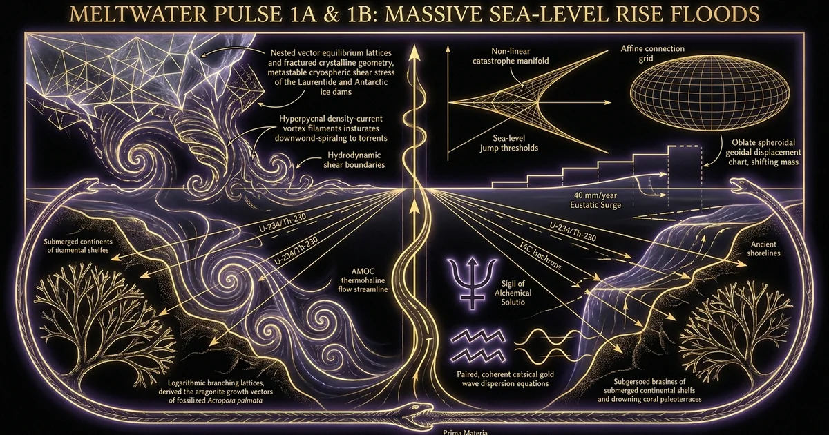
Meltwater Pulse 1A and 1B: Massive Sea-Level Rise Floods
Executive Summary & Theoretical Thesis
Non-Linear Deglaciation and Eustatic Discontinuities
The termination of the Last Glacial Maximum (LGM) was not characterized by a uniform, monotonic relaxation of global cryospheric volume. Instead, high-resolution geochronological frameworks demonstrate that the late-Quaternary transition from glacial to interglacial regimes was punctuated by high-amplitude, non-linear eustatic step-functions. Chief among these catastrophic discharge episodes were Meltwater Pulse 1A (MWP-1A) and Meltwater Pulse 1B (MWP-1B). These events injected vast volumes of freshwater directly into the global ocean, radically altering ocean thermohaline circulation, driving abrupt latitudinal shifts in atmospheric circulation cells, and precipitating rapid eustatic sea level increases that inundated low-gradient continental shelves across human generational timescales.
During these hyper-accelerated intervals, eustatic sea level rose at rates that exceeded modern baseline trends by more than an order of magnitude. The phenomenon termed meltwater pulse 1a 1b rapid sea level rise catastrophic flooding systematically redrew the global land-sea interface. Low-gradient continental shelves—constituting tens of millions of square kilometers of highly productive coastal territory—were submerged under marine transgressions that advanced inland at horizontal velocities of several hundred meters per year. These dynamic eustatic jumps severed terrestrial corridors, flooded maritime plains, and permanently altered the boundary conditions governing Quaternary climate stability.
EUSTATIC STEP-FUNCTION TRAJECTORY
     Eustatic
     Sea Level (m)
         0 |                                            Holocene Interglacial
           |                                       .-------------------------
       -20 |                                     /  [MWP-1B: ~11.45–11.1 ka BP]
           |                                    /   (+13 to 15 m)
       -40 |                                   /
           |               Younger Dryas Pause|
       -60 |                               ---|
           |                             /  [MWP-1A: ~14.65–14.31 ka BP]
       -80 |                            /   (+14 to 18 m, >40 mm/yr)
           |                           /
      -100 |          Oldest Dryas    /
           |         ----------------/
      -120 | Last Glacial Maximum (LGM)
           +-----------------------------------------------------------------
            20             16             14             12             10
                                    Time (ka BP)
The realization that ice sheets do not melt solely in a predictable thermodynamic equilibrium with solar insolation marks a major paradigm shift in Quaternary geology. Ice sheet collapse is fundamentally dynamic: structural instability, mechanical fracturing, grounding-line decoupling, and subglacial hydrological lubrications trigger abrupt thresholds where massive cryospheric reservoirs discharge catastrophically into oceanic sinks, yielding cumulative vertical dislocations exceeding a 40 meters sea level jump across the broader deglacial sequence.
The Geochronological Signatures of MWP-1A and MWP-1B
Geochronological constraint of these discharge events relies on high-precision mass-spectrometric dating of shallow-water hermatypic coral reef frameworks, most notably Acropora palmata and Porites species. The temporal footprint of MWP-1A is established between 14.65 and 14.31 calibrated kiloyears before present (ka BP), a period coinciding precisely with the Bølling warming inflection recorded in Greenland ice cores (NGRIP/GISP2). During MWP-1A, global mean sea level surged by 14 to 18 meters in less than 350 years, translating to mean rates of vertical displacement exceeding 40 mm/year, with localized peak discharge intervals approaching 50 mm/year.
“Uranium–thorium dates obtained from Tahiti coral reef cores recovered during Integrated Ocean Drilling Program (IODP) Expedition 310 demonstrate that sea level rose by 14 to 18 metres between 14.65 and 14.31 kiloyears ago… coinciding with the onset of the Bølling warming. The rate of eustatic sea-level rise during this event exceeded 40 millimetres per year.” Source: Deschamps, P., Durand, N., Bard, E., Hamelin, B., Camoin, G., Thomas, A. L., Henderson, G. M., & Yokoyama, Y. (2012). Nature, 483(7391), 559–564.
Conversely, the temporal bounds of Meltwater Pulse 1B remain centered between 11.45 and 11.10 ka BP, marking the immediate termination of the Younger Dryas cold chronozone and the inception of the Preboreal Holocene. MWP-1B registered an additional vertical displacement of 13 to 15 meters at rates estimated between 13 and 15 mm/year. The cumulative impact of these twin dislocations fundamentally reorganized global hydrology:
$$\Delta h_{\text{total}} = \int_{t_{\text{1A}}} \dot{\zeta}{\text{eustatic}}(t),dt + \int{t_{\text{1B}}} \dot{\zeta}_{\text{eustatic}}(t),dt \approx 30\text{ to }33\text{ m (discrete pulses)}$$
When integrated across the background deglacial melting baseline, these catastrophic pulses accounted for roughly one-third of the total 120-meter post-LGM oceanic transgression.
Threshold Physics: Cryospheric Collapse vs. Gradualist Uniformitarianism
The mechanics governing both MWP-1A and MWP-1B defy classical uniformitarian paradigms of deglaciation, which posited that continental ice sheets diminish solely via surface ablation driven by Milankovitch orbital configurations. In the orbital model, gradual variations in the precession-of-equinoxes and obliquity drive linear shifts in top-of-atmosphere insolation. However, empirical proxy records exhibit severe nonlinearities where small thermal forcings initiate rapid macroscopic disruptions.
This disconnect is resolved through the physics of threshold mechanics and marine ice-sheet instability. A continental ice sheet resting on bedrock below sea level with a retrograde (inward-sloping) bed topography is inherently metastably balanced. As oceanic thermal anomalies induce sub-shelf melting, the ice shelf thins, reducing back-stress (buttressing) on the interior ice stream. Once the grounding line retreats across an adverse bedrock slope, a positive feedback loop initiates: flux across the grounding line scales as a non-linear power of ice thickness, triggering runaway retreat independent of further atmospheric warming.
These physical dynamics explain how multi-centennial discharge surges occur. Rather than slow surface melting, the collapse involves the dynamic evacuation of entire marine-based subglacial sectors, accompanied by the structural failure of continental ice dams holding back proglacial lakes. Catastrophic subglacial flushing, combined with marine ice cliff collapse, transformed thousands of gigatons of grounded ice into sea water within decades, overwhelming the capacity of regional drainage systems and driving sudden eustatic sea-level leaps worldwide.
Historical Lineage & Experimental Precedents
Fairbanks’ Drillcores: The Barbados Acropora palmata Paradigm
The modern empirical understanding of non-linear deglaciation began with the offshore drilling expeditions conducted off the southern coast of Barbados by Richard G. Fairbanks in the late 1980s. Prior to this fieldwork, marine geology was dominated by smooth, low-resolution eustatic sea-level curves constructed from discontinuous coastal marsh peats and shallow-water molluscan assemblages. These older methodologies could neither resolve sub-millennial variations nor distinguish between local tectonic uplift and true global eustasy.
Fairbanks recognized that the branching coral Acropora palmata provides an exceptionally precise geological dipstick. A. palmata lives within a narrow, well-defined depth ecological niche, restricted almost exclusively to the upper 5 meters of the reef crest to maximize solar irradiance for its symbiotic zooxanthellae. By recovering continuous core samples from submerged fossil reef terraces extending down to 120 meters below modern sea level off Barbados, Fairbanks utilized accelerator mass spectrometry (AMS) radiocarbon dating to construct the first continuous, high-resolution post-glacial eustatic curve.
Analysis of offshore core holes (R-1, R-2, R-3) penetrating the submerged fore-reef slope along the south coast of Barbados documented clear drowned-reef morphologies. Intervals where Acropora palmata was abruptly superseded by deeper-water Montastraea annularis or submerged without recovery indicate instantaneous drowning events where vertical sea-level acceleration exceeded the maximum sustained vertical calcification and accretion rate of the reef framework (~10–12 mm/yr). Source: Fairbanks, R. G. (1989). ‘A 17,000-year glacio-eustatic sea level record.’ Nature, 342(6250), 637–642.
The Barbados cores exposed sharp, near-vertical offsets in the depth-versus-age distribution of A. palmata. Fairbanks identified two major disruptions in the accretion trajectory: Meltwater Pulse 1A, centered at ~12,100 $^{14}\text{C}$ years BP (~14,200 cal BP), and Meltwater Pulse 1B, situated at ~9,900 $^{14}\text{C}$ years BP (~11,300 cal BP). These data proved that sea-level rise was concentrated in episodic, high-velocity bursts capable of drowning tropical coral reefs.
Tahiti and Huon Peninsula: Disentangling Glacio-Isostatic Adjustment (GIA)
While the Barbados curve established the reality of meltwater pulses, its global universality remained contested due to the potential contamination of the local sea-level record by tectonism and local glacio-isostatic-adjustment. To establish a true eustatic baseline, paleoceanographers turned to far-field sites located thousands of kilometers from the Laurentide, Fennoscandian, and Antarctic ice sheets.
Drilling campaigns at the Huon Peninsula in Papua New Guinea and the Integrated Ocean Drilling Program (IODP) Expedition 310 at Tahiti provided the definitive far-field tests. The Huon Peninsula, characterized by rapid tectonic uplift that lifted fossil coral terraces clear of the sea, yielded an uplift-corrected eustatic curve that mirrored the Barbados timings. Decisively, the Tahiti drilling confirmed the exact timing and magnitude of MWP-1A. Located in an ocean basin isolated from the direct gravitational and flexural deformation fields of the major Northern Hemisphere ice masses, Tahiti’s slow, monotonic volcanic subsidence allows for precise, micro-stratigraphic dating via thermal ionization mass spectrometry (TIMS) uranium-thorium ($^{234}\text{U}$–$^{230}\text{Th}$) isotopic systematics.
FAR-FIELD ISOSTATIC & GRAVITATIONAL ARRAY
+------------------------------------------------------+
|             FAR-FIELD OBSERVATIONAL ARRAY            |
|                                                      |
|   [Tahiti: IODP 310]             [Huon Peninsula]    |
|   - Far-field baseline           - Fast tectonic     |
|   - U-Th TIMS precision            uplift terrace    |
|   - Monotonic subsidence         - Emerged series    |
|            \                            /            |
|             \                          /             |
|              v                        v              |
|        +------------------------------------+        |
|        |     RESOLVED GLOBAL FAR-FIELD      |        |
|        |           EUSTATIC SIGNAL          |        |
|        +------------------------------------+        |
|                          ^                           |
|                          |                           |
|                 [Barbados Drillcores]                |
|                 - Fairbanks (1989)                   |
|                 - Intermediate-field GIA             |
|                 - Acropora palmata reef drown        |
+------------------------------------------------------+
By cross-calibrating the Barbados, Huon, and Tahiti datasets through complex solid-Earth geophysical modeling, geophysicists decomposed local relative sea-level records into their constituent components: solid-Earth deformation, geoidal shifts, and true eustatic volume addition. This synthesis conclusively demonstrated that MWP-1A was a globally synchronous event, resolving previous ambiguities regarding whether the Caribbean drowning events were regional artifacts or planetary cryospheric ruptures.
The Paradigm Shift: From Uniformitarianism to Cryospheric Catastrophism
The empirical confirmation of MWP-1A and MWP-1B undermined the classical Lyellian doctrine of geological uniformitarianism that had dominated Quaternary science for over a century. Early uniformitarian assumptions dictated that ancient ice sheets melted at rates directly analogous to modern, slow ablation fronts observed in sub-polar mountain glaciers.
The emergence of non-linear deglacial models built on the work of J Harlen Bretz, whose once-vilified work on the Channeled Scablands of eastern Washington demonstrated that massive, catastrophic outbursts of proglacial lakes could reshape continental topography within hours. Applying this mega-flood dynamic to hemispheric ice sheets, modern paleoclimatologists realized that late-Pleistocene deglaciation was dominated by catastrophic hydraulic events. The recognition of mega-outburst events—such as the episodic breachings of glacial Lake Agassiz and the catastrophic surging of the Keewatin Ice Dome—realigned Quaternary geomorphology with non-linear dynamics, where long periods of metastable physical stress accumulation resolve through violent, short-duration discharges.
Mathematical Formalism & Physical Mechanics
Thermodynamic Instabilities and Ice-Stream Purges
The rapid disintegration of ice sheets during meltwater pulses requires physical mechanisms that bypass the standard thermal conductivity limits of solid water ice. The conduction of heat through an ice sheet obeys the Fourier thermal diffusion equation:
$$\frac{\partial T}{\partial t} = \kappa \nabla^2 T - \mathbf{u} \cdot \nabla T + \frac{Q_{\text{def}}}{\rho c_p}$$
where $\kappa$ is the thermal diffusivity of ice, $\mathbf{u}$ is the ice velocity vector, $Q_{\text{def}}$ is the strain heating from internal deformation, $\rho$ is the ice density, and $c_p$ is the specific heat capacity. Given the low thermal diffusivity of ice ($\kappa \approx 1.1 \times 10^{-6} \text{ m}^2/\text{s}$), atmospheric surface warming requires millennia to penetrate several kilometers through an ice sheet to destabilize its basal interface via pure thermal diffusion.
Consequently, the rapid collapse observed during MWP-1A must be driven by advective thermodynamic instabilities and basal mechanics. The accumulation of subglacial meltwater generated by frictional dissipation and geothermal heat fluxes produces elevated subglacial pore-water pressures ($p_w$). When the effective basal normal pressure:
$$N = \sigma_n - p_w$$
approaches zero, where $\sigma_n = \rho_i g H$ is the cryostatic overburden stress (for ice of thickness $H$), basal shear traction drops dramatically:
$$\tau_b = C N^m u_b^n \to 0$$
This drop in basal shear initiates a mechanical transition from internal plastic deformation to rapid plug flow via basal sliding. Ice streams operating under these conditions act as express drainage channels, evacuating vast interior catchments directly into the ocean.
RETROGRADE BED MISI DYNAMICS
  Sea Level
===========~~~~\___________________________
                \           Ice Shelf       \
                 \-------------------\       \   Sub-Shelf Melting
                                      \       \ <--- Warm Water
                         Grounding Line\       \    Intrusion
                                        \=======\
   Retrograde Bed Slope                  |       |
   ----------------------\               |       |
                          \              | Grounded
                           \             | Ice Sheet
                            \            |
                             \-----------+
When ice streams terminate in marine environments with retrograde bed slopes ($\frac{\partial b}{\partial x} > 0$, where $b(x)$ is bedrock depth below sea level measured positive downward inland), marine-ice-sheet-instability (MISI) governs the system. The discharge flux $q_g$ across the grounding line scales non-linearly with ice thickness at the grounding line ($h_g$):
$$q_g \propto h_g^\beta, \quad \beta \approx 4\text{ to }5$$
Because bedrock slopes downward toward the continental interior, any initial retreat of the grounding line shifts the boundary to deeper water, immediately increasing $h_g$ and exponentially driving up the ice discharge flux $q_g$, establishing a self-amplified feedback loop independent of external atmospheric forcing.
Glacio-Isostatic Adjustment and the Gravitational Fingerprint Equation
The release of freshwater during a meltwater pulse does not generate a globally uniform rise in relative sea level. The spatial variability of sea-level change is modeled by the Sea-Level Equation, formulated by Farrell and Clark (1976), which governs the redistribution of ocean water on a viscoelastic, self-gravitating Earth:
The spatio-temporal distribution of relative sea level change, $\Delta S(\theta, \phi, t)$, across colatitude $\theta$, longitude $\phi$, and time $t$ is expressed through the integral equation: $$\Delta S(\theta, \phi, t) = \frac{\rho_i}{\bar{\rho}e} \iint{\Omega_i} \Delta I(\theta’, \phi’, t) G_\phi(\gamma) , d\Omega’ + \frac{\rho_w}{\bar{\rho}e} \iint{\Omega_o} \Delta S(\theta’, \phi’, t) G_\phi(\gamma) , d\Omega’ + \frac{\Delta \Phi(t)}{g}$$ where:
- $\Delta I$ is the variation in ice sheet thickness across the glaciated domain $\Omega_i$,
- $\Delta S$ is the sea-level change over the oceanic domain $\Omega_o$,
- $\rho_i$ and $\rho_w$ denote the densities of ice and seawater,
- $\bar{\rho}_e$ is the average density of the solid Earth,
- $G_\phi(\gamma)$ represents the viscoelastic Green’s function for surface mass loading at angular distance $\gamma$,
- $\Delta \Phi(t)$ is the spatially uniform, time-dependent offset required to strictly satisfy the conservation of total mass.
The Green’s function decomposes into viscoelastic load Love numbers ($h_n, l_n, k_n$):
$$G_\phi(\gamma) = \frac{a}{M_e} \sum_{n=0}^{\infty} \left( 1 + k_n’ - h_n’ \right) P_n(\cos \gamma)$$
where $a$ is the mean radius of Earth, $M_e$ is Earth’s mass, and $P_n$ are Legendre polynomials.
This formulation uncovers the gravitational fingerprinting mechanism: as a massive ice sheet rapidly discharges, its gravitational attraction over the adjacent ocean ceases. Consequently, sea level actually drops within the immediate near-field (within ~2,000 km of the disintegrating ice sheet), despite the injection of thousands of gigatons of water. Conversely, in the far-field (e.g., the equatorial Pacific and Indian Oceans), sea level rises above the global mean eustatic average:
$$\Delta S_{\text{far-field}} > \Delta \zeta_{\text{eustatic}} > \Delta S_{\text{near-field}}$$
This gravitational and isostatic decoupling dictates that empirical reconstructions of eustasy require inverse solutions of the Sea-Level Equation to accurately locate the balance between Laurentide, Fennoscandian, and Antarctic ice-source domains.
Hydrodynamic Modeling of Continental Paleochannel Inundation
The rapid injection of meltwater into continental shelf systems triggered non-uniform, turbulent paleochannel inundations governed by the shallow water equations. Depth-averaged hydrodynamics across low-gradient continental shelves are modeled by the conservative Saint-Venant formulation:
$$\frac{\partial \mathbf{U}}{\partial t} + \frac{\partial \mathbf{F}(\mathbf{U})}{\partial x} + \frac{\partial \mathbf{G}(\mathbf{U})}{\partial y} = \mathbf{S}(\mathbf{U})$$
where the state vector $\mathbf{U}$, flux vectors $\mathbf{F}, \mathbf{G}$, and source vector $\mathbf{S}$ represent:
$$\mathbf{U} = \begin{bmatrix} h \ hu \ hv \end{bmatrix}, \quad \mathbf{F} = \begin{bmatrix} hu \ hu^2 + \frac{1}{2}gh^2 \ huv \end{bmatrix}, \quad \mathbf{G} = \begin{bmatrix} hv \ huv \ hv^2 + \frac{1}{2}gh^2 \end{bmatrix}, \quad \mathbf{S} = \begin{bmatrix} 0 \ -gh \frac{\partial z_b}{\partial x} - C_f u \sqrt{u^2+v^2} \ -gh \frac{\partial z_b}{\partial y} - C_f v \sqrt{u^2+v^2} \end{bmatrix}$$
Here, $h$ is water depth, $u$ and $v$ are horizontal velocity components, $z_b$ is the bathymetric elevation, and $C_f$ is the non-linear bottom friction coefficient.
When proglacial lakes breached during catastrophic discharge intervals, peak instantaneous volumetric discharges exceeded $Q_p \sim 10^6 \text{ m}^3/\text{s}$. These fresh, suspended-sediment-laden flows formed dense hyperpycnal-flow regimes upon reaching marine deltas. The density of the hyperpycnal discharge ($\rho_f$) exceeded ambient ocean density ($\rho_o$) due to extreme sediment loading ($C_s$):
$$\rho_f = \rho_w (1 - C_s) + \rho_s C_s > \rho_o$$
These negative-buoyancy plumes plunged down the continental slope as sub-aqueous turbidity mega-currents, gouging canyon systems and depositing extensive graded sediment lobes throughout continental margins, as detailed in models of /physics-electromagnetism/fluid-dynamics-hyperpycnal-discharge.
Comparative Dynamics: Laurentide vs. Antarctic Source Sinks
The Northern Source Debate: Lake Agassiz and the Keewatin Ice Dome
For decades following Fairbanks’ initial discoveries, paleoclimatologists assumed that Meltwater Pulse 1A was sourced entirely from the massive northern Laurentide Ice Sheet (LIS). Proponents argued that the rapid warming of the Bølling chronozone accelerated surface melting, causing the catastrophic subglacial drainage and subsequent collapse of the interior Keewatin and Foxe ice domes.
Geomorphological and stable isotopic evidence confirms that major meltwater diversions occurred across North America. Subglacial outburst routes carved expansive spillway networks through the Mississippi River system into the Gulf of Mexico, while eastward routings discharged through the St. Lawrence Valley and Hudson Strait into the North Atlantic. Glacial Lake Agassiz, which reached volumes exceeding $160,000\text{ km}^3$, underwent multiple catastrophic drainages. When ice dams holding this freshwater ruptured, discharge rates soared, purging interior ice complexes and releasing enormous quantities of icebergs directly into the subpolar gyre.
       SOURCE DYNAMICS & CONFLICTING SIGNATURES
Northern Source (Laurentide):
  - Proglacial mega-lakes breach (Lake Agassiz)
  - Freshwater into Gulf of Mexico & North Atlantic
  - AMOC Shutdown Paradox: Discharges align with
    Bølling Warming (vigorous AMOC), not collapse

Southern Source (Antarctic):
  - Circum-Antarctic grounding-line retreat
  - Transgressions amplify in Northern Hemisphere
  - Geochemical proxies confirm dual-hemispheric release
However, a Northern Hemisphere origin poses a fundamental paleoceanographic paradox: the large-scale injection of freshwater into the subpolar North Atlantic should have halted the Atlantic Meridional Overturning Circulation (AMOC) by stratifying the surface ocean and shutting down North Atlantic Deep Water (NADW) formation. Yet, high-resolution marine proxies reveal that MWP-1A occurred precisely at the onset of the Bølling interstadial, a period when the AMOC intensified rather than collapsed. This thermodynamic contradiction forced researchers to reassess the geography of deglacial meltwater routing.
The Southern Divergence: Antarctic Ice Sheet Contribution
To reconcile the AMOC paradox, Clark et al. and subsequent modeling teams proposed that a substantial fraction of MWP-1A originated from the Antarctic Ice Sheet (AIS), particularly the marine-based West Antarctic Ice Sheet (WAIS) and coastal sectors of the East Antarctic Ice Sheet (EAIS), such as the Wilkes Subglacial Basin.
A major Antarctic discharge circumvents the North Atlantic overturning dilemma. Sourcing meltwater from the Southern Hemisphere freshens Antarctic Intermediate Water and Antarctic Bottom Water (AABW) pathways without capping NADW formation sites. Numerical ocean circulation models demonstrate that freshwater forcing applied to the Southern Ocean can induce a “bipolar seesaw” response, accelerating AMOC overturning and driving northern warming via increased northward oceanic cross-equatorial heat transport.
Geological field surveys in the Ross Sea and Weddell Sea embayments provide physical confirmation of this southern source. Deep glacial-marine drillcores demonstrate extensive grounding-line retreats across the Antarctic continental shelf during the 14.6 to 14.3 ka BP window. The destabilization of marine-grounded Antarctic ice sheets was likely triggered by deep sub-surface warming: the influx of modified Circumpolar Deep Water (CDW) beneath floating ice shelves melted their structural pinning points from below, triggering runaway marine ice-sheet instability.
Geophysical Fingerprinting of Pulse Discharges
The application of the Farrell and Clark sea-level equation provides the mathematical means to test the relative contributions of the Laurentide and Antarctic sources during MWP-1A and MWP-1B. Because the gravitational pull of an ice sheet diminishes as it melts, the spatial pattern—or “fingerprint”—of sea-level rise uniquely identifies the contributing ice reservoirs.
If MWP-1A were sourced solely from the Laurentide Ice Sheet, the Caribbean relative sea-level rise recorded at Barbados would measure approximately 100% to 110% of the global mean eustatic value. Concurrently, far-field sites in the southern equatorial Pacific (such as Tahiti) would register a significantly higher sea-level jump—exceeding 120% to 130% of the eustatic average—due to the profound reduction of mass in the northern polar region.
Geochemical isotopic evidence provides an orthogonal check on these geophysical models:
- Neodymium isotopic ratios ($\varepsilon_{\text{Nd}}$) traced across Atlantic deep-sea sediment cores document pristine weathering inputs from the ancient crystalline cratons surrounding Hudson Bay, tracking the exact pathways of LIS runoff.
- High-resolution oxygen isotope ratios ($\delta^{18}\text{O}$) in planktonic foraminifera establish the presence of dramatic low-salinity surface plumes in both the Gulf of Mexico and the circum-Antarctic seas precisely during the initiation of MWP-1A.
These complementary fingerprints confirm a multi-source architecture. MWP-1A was a poly-cryospheric event: approximately 8 to 11 meters of equivalent eustatic sea level was derived from the Antarctic Ice Sheet, while the remaining 5 to 7 meters drained from the Laurentide and European ice sheets.
By contrast, the later Meltwater Pulse 1B exhibits a heavily northern-dominated fingerprint. MWP-1B represents the final collapse of the residual North American interior ice domes, combined with the catastrophic drainage of the Baltic Ice Lake and the rapid retreat of the Scandinavian Ice Sheet at the dawn of the Preboreal.
Meltwater Pulse 1A (MWP-1A)
- Temporal Onset: ~14.65–14.31 ka BP (340-year duration)
- Eustatic Magnitude: 14 to 18 meters
- Peak Discharge Rate: >40 to 50 mm/year
- Primary Ice Sources: Dual-hemisphere: West Antarctic Ice Sheet (predominant, ~8–11 m) + Laurentide/Fennoscandian (~5–7 m)
- Paleoclimatic Boundary: Synchronous with the Bølling Warming inflection; AMOC accelerates; rapid Greenland warming
- Oceanographic Signature: Widespread Antarctic Bottom Water (AABW) freshening; localized mega-spillways in the Gulf of Mexico
Meltwater Pulse 1B (MWP-1B)
- Temporal Onset: ~11.45–11.10 ka BP (350-year duration)
- Eustatic Magnitude: 13 to 15 meters
- Peak Discharge Rate: 13 to 15 mm/year
- Primary Ice Sources: Northern Hemisphere: Laurentide Ice Sheet remnants + Baltic Ice Lake / Scandinavian Ice Sheet
- Paleoclimatic Boundary: Younger Dryas / Preboreal boundary; terminates Younger Dryas cold reversal; initiates early Holocene
- Oceanographic Signature: Final hyperpycnal flushing of North American/European marginal lakes; stabilization of modern AMOC regime
Empirical Evidence & Observational Data
Submerged Terrains: Sundaland, Sahul, and Doggerland
The most profound physical consequence of the 40 meters sea level jump driven by the combined impacts of MWP-1A and MWP-1B was the drowning of vast, low-gradient continental shelves across the globe. Prior to these pulses, millions of square kilometers of continental shelves were fully subaerial, supporting complex river drainage systems, vast terrestrial biomes, and terminal Paleolithic human populations.
POST-LGM CONTINENTAL MARGIN TRANSIENT
  Modern Coastline
      |
      |                 MWP-1B Shoreline (~11.1 ka BP)
      |                       |
      v                       v           MWP-1A Shoreline (~14.3 ka BP)
  ----+-----------------------+-----------+-----------------------------+--- [LGM Shelf Edge]
      |   DOGGERLAND /        |           |                             |
      |   SUNDALAND SHELF     |           |                             |
      |                       |           |                             |
      |      ~15 mm/yr        | ~40 mm/yr |                             |
      |<----------------------|<----------|                             |
                 Transgression Velocities: Up to 500–1000 m/yr Inland
In Sundaland—the continental shelf underlying modern maritime Southeast Asia—an area spanning more than 1.8 million square kilometers connected the modern islands of Sumatra, Java, and Borneo to mainland Indochina. High-resolution multibeam bathymetric mapping and sub-bottom seismic profiling have revealed extensive incised paleovalley systems, such as the North Sunda and East Sunda Rivers, carved through the shelf. During MWP-1A, the shoreline in the Sunda plain advanced inland at rates exceeding 500 to 1,000 meters per year across flat alluvial plains. Mangrove peat horizons and drowned estuarine muds cored beneath modern seabed deposits document this rapid transition, where vast terrestrial ecosystems were submerged beneath shallow epicontinental seas within human lifetimes.
A structurally identical marine transgression submerged Doggerland—the low-lying landbridge that connected modern Great Britain to continental Europe across the southern North Sea basin. Sub-bottom profilers have mapped drowned braided river systems, freshwater lacustrine basins, and submerged sand-dune complexes. Sediment cores recovered from the Dogger Bank demonstrate an abrupt facies succession from subaerial marsh peats to marine silts, precisely dated to the boundary conditions defined by MWP-1A, MWP-1B, and the subsequent early Holocene Storegga-slide transgression.
In the southern hemisphere, the Sahul Shelf—uniting Australia, New Guinea, and Tasmania—experienced catastrophic marine incursions that drowned the Gulf of Carpentaria and severed the Torres and Bass Straits, isolating landmasses and fragmenting human and animal populations across the Australasian bioregions.
Sedimentary Records of Incised Paleovalleys and Hyperpycnal Deposits
Continental margins preserve the physical signature of the extreme hydraulic energies that operated during these discharge intervals. Sedimentary cores taken across the continental slope seaward of major paleodrainage corridors—including the ancestral Mississippi, Columbia, Rhine, and St. Lawrence rivers—reveal anomalous, thick, unbioturbated sediment successions classified as hyperpycnites.
These deposits reflect conditions where the sediment load carried by catastrophic glacial outburst waters was so concentrated that the discharged river water was denser than the receiving seawater. Instead of forming a buoyant, floating plume (hypopycnal flow), the meltwater plunged directly down the continental margin as a continuous, destructive gravity current. Marine cores collected from the deep Gulf of Mexico reveal stacked turbidite sequences containing:
- Terrestrial organic detritus,
- Reworked continental palynomorphs,
- Quartz-rich terrigenous sands, and
- Distinct sub-aqueous traction structures directly calibrated to the MWP-1A timeline.
Submarine canyons along the North Atlantic margin preserve high-energy bypass features. Deep-tow seismic reflection profiles reveal that during the peak discharge pulses, incised paleovalleys were not backfilled through gradual estuarine sedimentation; rather, they were rapidly drowned and choked with coarse-grained clastic mass flows as sea-level transgressions transformed former terrestrial trunk rivers into marine embayments virtually overnight.
Benthic Foraminifera d18O Anomalies and Marine Core Stratigraphy
The physical reality of MWP-1A and MWP-1B is fundamentally anchored in the stable isotopic stratigraphy of both planktonic and benthic foraminifera. The oxygen isotope composition ($\delta^{18}\text{O}$) of foraminiferal calcite ($\text{CaCO}_3$) records both ambient seawater temperature and the isotopic composition of the global ocean ($\delta^{18}\text{O}_w$), which is directly controlled by the global volume of isotopically light continental ice:
$$\delta^{18}\text{O}{\text{calcite}} - \delta^{18}\text{O}{w} = f(T)$$
Because continental ice sheets are strongly depleted in heavy oxygen ($^{18}\text{O}$) due to Rayleigh fractionation during atmospheric vapor transport toward the poles (with ice values often reaching $\delta^{18}\text{O}_{\text{ice}} \approx -35\text{ to }-50\text{ \textperthousand}$), the catastrophic release of up to $18,000\text{ km}^3/\text{year}$ of meltwater produces severe, negative $\delta^{18}\text{O}$ spikes in the surface ocean.
Planktonic foraminifera such as Globigerinoides ruber and Neogloboquadrina pachyderma recovered from cores adjacent to glacial discharge spillways record profound isotopic excursions. During MWP-1A, the $\delta^{18}\text{O}$ values in the northern Gulf of Mexico drop by up to $3\text{ \textperthousand}$ to $4\text{ \textperthousand}$ within centuries. This depletion exceeds what could be generated by any realistic ocean-temperature increase, confirming the catastrophic influx of light, cryosphere-derived waters. Concurrently, deep-sea benthic foraminifera (such as Cibicidoides wuellerstorfi) exhibit a slower, uniform, step-function decline across global ocean basins, chronicling the permanent downward shift in the global oceanic isotopic baseline as $40\text{ meters}$ of melted ice mixed through the thermohaline conveyor.
Civilizational Impact & Universal Mythological Synthesis
Paleolithic Population Displacements and Coastal Abandonment
The late-Pleistocene eustatic leaps profoundly restructured human biogeography. The continental shelves submerged by MWP-1A and MWP-1B were not barren terrains; they represented the most ecologically fertile, biomass-dense habitats available to Upper Paleolithic and Mesolithic foraging societies. Coastal environments offered rich marine, estuarine, and alluvial food sources that supported sedentary and semi-sedentary human populations.
The rapid horizontal migration of the shoreline disrupted these societies. In regions with exceptionally flat shelf bathymetry—such as the Persian Gulf, the Sunda Shelf, and Doggerland—a vertical sea-level rise of 40 mm per year translated to a horizontal landward advance of the ocean of hundreds of meters annually. Within a single human generation of 25 years, the shoreline shifted inland by 5 to 15 kilometers, permanently drowning ancestral settlements, resource catchments, and territorial boundaries.
ECOLOGICAL REFUGEE DISPLACEMENT VECTORS
+--------------------------------------------------------+
|              PALEOLITHIC COASTAL BIOMES                |
|  - High biomass carrying capacity                      |
|  - Sedentary / semi-sedentary foraging zones           |
+--------------------------------------------------------+
                            |
                            | MWP-1A & MWP-1B Transgressions
                            | (Horizontal advance: up to 1 km/yr)
                            v
+--------------------------------------------------------+
|                CATASTROPHIC DROWNING                   |
|  - Inundation of paleochannels & coastal plains        |
|  - Inversion of river drainage (backwater flooding)    |
+--------------------------------------------------------+
                            |
                            | Forced Interior Relocation
                            v
+--------------------------------------------------------+
|                  INTERIOR REFUGIA                      |
|  - Territorial compression                             |
|  - Resource competition & structural violence          |
|  - Cultural & symbolic reorganization                  |
|  - Megalithic monumentality as ecological anchors      |
+--------------------------------------------------------+
This rapid drowning forced immediate, sustained inland migrations. Archaeological site distributions in Western Europe, East Asia, and the Americas display clear signatures of interior displacement during the Bølling-Allerød and Preboreal transitions. Displaced maritime hunter-gatherers were compressed into higher-elevation interior refugia already occupied by indigenous groups. This dynamic fueled territorial friction, resource scarcity, and structural violence, forcing rapid cultural transformations. The transition toward early agricultural strategies in the Near East and the rise of monumental architectural complexes—examined at sites linked with /ancient-prehistory/submerged-megalithic-topographies and the broader paleoclimatic crises of the /ancient-prehistory/younger-dryas-impact-hypothesis—can be viewed as organizational adaptations designed to stabilize human populations amid the environmental collapse of coastal biomes.
Archetypal Memory: The Transmission of Universal Deluge Narratives
One of the most persistent and cross-cultural phenomena in global comparative mythology and archaic oral literature is the Deluge archetype. From the Mesopotamian Epic of Atrahasis and the Epic of Gilgamesh, to the Vedic Shatapatha Brahmana (the legend of Manu), the Mesoamerican Popol Vuh, and widespread Indigenous American, Oceanic, and Australian mythologies, narratives describing a sudden, all-consuming oceanic transgression that obliterated a former world order form a consistent mythic baseline.
Rather than dismissing these universal narratives as pure psychological allegories or localized river-flood motifs, geomythology contextualizes them as the preservation of catastrophic deglacial sea-level jumps. The sheer scale and speed of MWP-1A and MWP-1B etched these occurrences into the cultural memories of surviving populations.
“Aboriginal stories from 21 locations around the Australian coastline accurately describe the post-glacial drowning of the continental shelf… In many cases, these traditions consistently attribute the permanent loss of land, islands, and coastal plains to rapid sea-level rises that can be dated using eustatic curves to between 13,000 and 7,000 years BP, representing genuine multi-millennial oral survivals of deglacial meltwater dynamics.” Source: Nunn, P. D., & Reid, N. J. (2016). ‘Aboriginal Memories of Inundation of the Australian Coast Dating from More than 7000 Years Ago.’ Australian Geographer, 47(1), 11–47.
These oral lineages survived intact across hundreds of generations through institutionalized mnemonic structures, ritualistic chants, and sky-ground cognitive mapping frameworks linked with /sacred-geometry/paleolithic-astronomy-and-axial-precession. The survival of these traditions confirms that late-Quaternary human populations possessed mechanisms capable of accurately transmitting factual observations of environmental catastrophes across millennia.
Geomythology and Cognitive Mapping of Disrupted Coastal Biomes
Geomythological analysis demonstrates that deluge myths typically contain precise physical signatures of deglacial mechanics:
- Marine incursions combined with violent inland backwater ponding,
- Earthquakes and subterranean collapses (indicative of post-glacial rebound-induced faulting),
- Dense, prolonged precipitation systems generated by altered atmospheric evaporation rates over newly formed shallow epicontinental seas.
When sea level surged at 40 mm per year, standard river drainage systems were overwhelmed. As rising oceans invaded river mouths, the hydraulic backwater effect forced inland rivers to reverse, pool, and break their banks, flooding interior basins hundreds of miles away from the coast. To human populations settled along these river valleys, the flood appeared simultaneously from the rivers and the sea, mimicking a coordinated planetary submergence.
These catastrophic events altered human metaphysical frameworks. The collapse of entire landscapes eroded the perceived permanence of terrestrial geography, instilling a worldview where the earth was inherently unstable and subject to cyclical purges. Sacred architectures and megalithic enclosures served as symbolic terrestrial anchors—efforts to re-establish cosmological order, track precession-of-equinoxes parameters, and measure the cycles of a dynamic and unstable planetary environment.
Frequently Asked Questions
Technical Distinctions Between MWP-1A and MWP-1B
While both events represent major eustatic perturbations, their paleoceanographic boundary conditions, durations, rates, and cryospheric sources are distinct:
MWP-1A (~14.65 to 14.31 ka BP) occurred during the termination of the Oldest Dryas and directly triggered the Bølling-Allerød warm interstadial. It was the more violent of the two pulses, registering vertical sea-level acceleration rates in excess of 40 mm/year. Its primary source reservoir was the Antarctic Ice Sheet, supplemented by substantial contributions from the Laurentide and Fennoscandian sheets, allowing the North Atlantic overturning circulation to strengthen.
MWP-1B (~11.45 to 11.10 ka BP), by contrast, terminated the severe, thousand-year cold snap of the Younger Dryas and accompanied the transition into the early Holocene (Preboreal). Its peak vertical rates were lower, measuring approximately 13 to 15 mm/year, for a cumulative vertical rise of roughly 13 to 15 meters. MWP-1B was dominated by Northern Hemisphere sources, representing the structural collapse of the remaining Canadian Laurentide ice domes and the emptying of massive ice-dammed meltwater lakes into the North Atlantic.
Resolving Conflicting Sea-Level Proxy Records
Apparent discrepancies among Caribbean (Barbados), Indo-Pacific (Tahiti, Huon), and European relative sea-level records are resolved by accounting for three primary factors: glacio-isostatic adjustment (GIA), mantle rheology, and tectonic displacement.
Every marine proxy record measures relative sea level (RSL), which represents the difference between the local sea surface and the solid-Earth sea floor:
$$\text{RSL}(\theta, \phi, t) = \Delta S(\theta, \phi, t) - \Delta R(\theta, \phi, t)$$
where $\Delta S$ is the perturbation of the geoid/ocean surface and $\Delta R$ is the radial displacement of the solid Earth beneath the observation site.
Because the Earth’s mantle behaves as a highly viscous fluid over millennial timescales, the rapid removal of ice masses from North America and Scandinavia caused the crust underneath to rebound (uplift), while the displaced mantle material forced peripheral forebulges—such as those near the US East Coast and the North Sea—to subside. Far-field sites like Tahiti experience negligible forebulge collapse but undergo ocean syphoning, a process where water is drawn toward subsiding near-field zones.
By applying three-dimensional viscoelastic Earth models that integrate Maxwell rheologies (lithospheric thickness, upper mantle viscosity, and lower mantle viscosity), geophysicists mathematically remove these regional deformation signatures to converge on a single, global eustatic curve.
RESOLVING DISCREPANCIES VIA GIA MODELING
  Observed Relative Sea Level Curve (Proxy Record)
                        |
                        v
  [-] Tectonic Corrections (Sub-bottom seismic / Active fault data)
  [-] Glacio-Isostatic Adjustment (GIA) Love Number Deconvolutions
  [-] Gravitational Self-Attraction (Farrell & Clark Green's functions)
  [-] Local Hydrodynamic / Estuarine Tides Correction
                        |
                        v
     TRUE GLOBAL MEAN EUSTATIC STEP-FUNCTION CURVE
Modern Cryospheric Analogues and Runaway Sea-Level Risk
The physical mechanisms that drove MWP-1A and MWP-1B provide crucial insights for understanding modern ice-sheet dynamics in a warming world. Contemporary assessments of polar cryospheric stability have identified the West Antarctic Ice Sheet—and specifically the Thwaites and Pine Island Glacier catchments—as exhibiting the precise morphological vulnerability that drove late-Pleistocene pulses: retrograde bedrock topography.
Modern satellite radar altimetry and subglacial swath bathymetry reveal that the grounding lines of Thwaites Glacier and the Totten Glacier in East Antarctica are retreating into deep interior subglacial basins. If warm Circumpolar Deep Water continues to undercut the marine-terminating ice shelves that buttress these glaciers, the grounding lines will cross critical pinning points, initiating runaway marine-ice-sheet-instability (MISI) and marine ice-cliff instability (MICI).
The geochronological record of MWP-1A and MWP-1B proves that ice sheets do not require thousands of years to collapse. When structural and mechanical thresholds are breached, vertical sea-level rise can rapidly accelerate from millimeters to decimeters per decade. Late-Quaternary paleoceanography reveals that rapid eustatic leaps are basic features of the Earth’s climate system when structural stability thresholds are crossed.