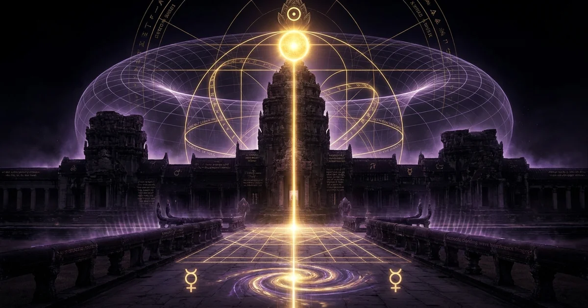
Angkor Wat Solar Architecture: Equinox Sunrise on Tower
Executive Summary & Theoretical Thesis: Archaeoastronomical Calibration of the Central Bakan
The spatial composition of Angkor Wat represents an apex of monumental chronographic engineering, operating simultaneously as a dynastic reliquary, a geometric manifestation of Vedic cosmography, and an empirical solar observatory. Erected during the first half of the twelfth century under the reign of Suryavarman II, the temple complex integrates astronomical constants into its petrified infrastructure. While classical architectural historiography long classified the monument primarily through the lens of aesthetic aggrandizement and theological iconography, modern archaeoastronomical fieldwork reveals that the complex functions as an integrated macro-scale chronographic resonator and spatialized solar ephemeris. At the core of this structural apparatus lies the precision calibration of its horizontal and vertical sightlines, engineered to interface with fundamental orbital anomalies, cyclic solstitial sweeps, and the exact vector of the vernal and autumnal equinoxes.
“The western approach to Angkor Wat is oriented to within a fraction of a degree of the equinoctial sunrise… The probability that these alignments are fortuitous is vanishingly small, demonstrating an intentional institutional integration of calendar, spatial layout, and royal theology.” — Stencel, R., Gifford, F., & Morón, E., Astronomy and Cosmology at Angkor Wat, Science, Vol. 193, No. 4250 (1976), pp. 281–287. DOI: 10.1126/science.193.4250.281
The Vernal and Autumnal Equinoctial Sightline Mechanics
The primary optical axis of Angkor Wat is established along an east-west trajectory that diverges marginally from true geodetic cardinal directions to execute a deliberate observational function. When observed from the primary threshold of the western entrance gate—the outer western gopura—during the astronomical equinoxes (solar declination $\delta = 0^\circ$), the solar disk ascends directly behind the apex of the central sanctuary tower, known as the Bakan. This alignment is not an approximation; it constitutes a strictly governed optical baseline wherein the elevation angle of the observer, the length of the elevated western causeway, and the towering altitude of the central lotus prang intersect to create a solar framing event of extreme precision.
The mechanics of this sightline rely on the precise interplay between geodetic horizontal displacement and vertical elevation. As the solar disk clears the physical horizon, its apparent trajectory is affected by atmospheric refraction and local topographical conditions. The Khmer architects accounted for these physical vectors by raising the central sanctuary upon three stacked tiers of concentric terraces, lifting the final lotus finial to an elevation of approximately sixty-five meters above the surrounding alluvial plain. When an observer stands at the designated astronomical observation station situated along the centerline of the western causeway, the angular diameter of the solar disk (approximately $0.53^\circ$) corresponds precisely with the structural tapering of the uppermost tower pinnacle, transforming the megalithic architecture into a solar transit chronometer.
This visual phenomenon is governed by rigorous geometric constraints. Rather than terminating in a generalized horizon observation, the primary causeway acts as an extended linear collimator. The physical trajectory isolates the rising sun precisely at the transition point where the tropical year bisects its orbital trajectory between the northern and southern hemispheres. The temporal calibration allows the observer to mark not only the astronomical vernal equinox—initiating the solar cycle corresponding to the traditional Khmer and Indian New Year—but also the autumnal counterpoint, validating the symmetry of the tropical year across the monument’s longitudinal axis.
Spatialization of Ephemerides in Megalithic Sandstone Architecture
The engineering brilliance of Angkor Wat resides in its operational capacity to translate transient celestial phenomena into permanent spatial coordinates. In an era predating mechanical horology and high-precision optical lenses, the preservation of an accurate agricultural and ritual calendar required physical structures capable of resisting environmental degradation and tectonic settling. The megalithic sandstone and laterite blocks composing the complex serve as a solid-state data storage medium, embedding ephemeris tables within the dimensional intervals separating causeways, courtyards, galleries, and sanctum thresholds.
The dimensional cadence of the architecture is not arbitrary; it scales proportionately to the cyclic movements of the sun and the moon. The lengths of specific corridors, the step counts of monumental stairways, and the distances between the outer enclosures correspond systematically to the mathematical periods governing the solar year ($365.24$ days), lunar synodic intervals ($29.53$ days), and the broader precessional oscillations of the celestial sphere. This spatialization process converts dynamic temporal mechanics into stationary spatial intervals, enabling priestly astronomers to calibrate time through metric spatial interrogation.
By crystallizing orbital mathematics into monumental sandstone, Angkorian engineers eliminated the cumulative drift inherent to purely observational reckoning. The physical architecture served as both calibration tool and standardizing medium: any perturbation in the perceived position of the equinoctial sunrise relative to the central tower signaled immediate structural or temporal deviations. This synthesis established an empirical baseline that aligned agrarian scheduling, flood-control regimes of the vast hydrological baray systems, and royal consecration rituals into a synchronized cycle.
Paradigmatic Synthesis of Metric Geodesy and Vedic Solar Theology
The structural execution of Angkor Wat manifests a confluence of geodetic survey techniques and imported Indic cosmography. Within the philosophical framework of the Khmer court, the temple was conceptualized as a physical instantiation of Mount Meru, the golden mountain situated at the cosmological center of the universe within Hindu cosmology. This mythological axis mundi was simultaneously recognized by the Khmer astronomical elite as the celestial polar axis around which the macrocosmic heavens rotated. Consequently, the construction of an architectural counterpart necessitated absolute precision in geodetic and celestial orientation.
This theoretical synthesis required that the solar transit across the central tower not merely function as a spectacle of royal aggrandizement, but fundamentally demonstrate the monarch’s direct attunement to divine cosmic law (rta). Suryavarman II was venerated as an earthly incarnation of Vishnu, the solar deity who traverses the celestial vaults in three strides. The physical alignment of the king’s central monument with the solar-zenith and equinoctial cycles substantiated this theology by producing visible empirical proof of divine synchronization during royal ceremonies. The solar disc crowning the pinnacle of the Bakan at the equinoctial dawn visually re-enacted the descent of Vishnu into the sanctum sanctorum, wedding geodetic layout to esoteric royal soteriology.
This intersection between practical geodesy and sacred metaphysics is visible in other global monument complexes. Researchers investigating the Chaco Canyon solar alignments and the metrological layout of the Great Pyramid and its Orion-geodetic correlations observe analogous methodologies: cultures across distant geographic zones codified the seasonal extremes of solar physics into colossal stone matrices. At Angkor Wat, however, this empirical paradigm was further synthesized with cyclic temporal cosmology, yielding an architecture where every metric coordinate participates directly in an unfolding celestial ephemeris.
Historical Lineage & Epistemological Precedents: From Suryavarman II to Modern Epigraphy
The historical context of Angkor Wat’s construction requires an evaluation of the epigraphic, architectural, and metrological lineage that guided its realization between 1113 and approximately 1150 CE. Modern understanding of this complex evolved through successive phases of scholarship, progressing from colonial descriptive cataloging toward rigorous mathematical archaeoastronomy. Decoding this monumental enterprise requires dissecting both the direct epigraphic evidence left by the Khmer empire and the interpretive frameworks applied by successive generations of twentieth-century archaeologists and epigraphers.
The primary epigraphic record establishing Suryavarman II’s consecration and astrological calibrations is preserved across multiple stele fragments, most notably the K. 298 and K. 493 epigraphs, detailing the puja ceremonies, the elevation of the golden linga, and the royal astrologers (astrologues royaux) tasked with calculating auspicious celestial vectors (muhurta).
Epigraphic Records and Royal Consecration (1113–1150 CE)
The architectural inception of Angkor Wat was inaugurated upon the ascension of King Suryavarman II to the Khmer throne in 1113 CE, following the political consolidation of competing regional polities. The foundation of this monumental enterprise was deeply integrated with the royal chaplain and guru, Divakarapandita, an influential Brahmanical figure whose career spanned the reigns of several Angkorian kings. Epigraphic inscriptions, particularly those cataloged across Cambodian stele corpora such as K. 298 and K. 493, characterize Divakarapandita as an initiate into Vedic astronomical literature, esoteric Shaiva-Vaishnava liturgies, and sacred mathematics. Under his spiritual and scientific supervision, the temple’s ground plan was consecrated to align with astronomical vectors, establishing an empirical foundation for the royal cult of Vishnu.
Khmer royal inscriptions do not divorce the act of construction from the temporal ordering of the cosmos. The monarch was not merely an earthly commander of labor; he was the Dharmaraja and Devaraja, the personal nexus through which cosmic harmony was mediated down to the territorial kingdom. Inscriptions highlight the performance of elaborate astronomical sacrifices—including Kotihoma and Lakshahoma rituals—explicitly linked to planetary junctions, solstices, and solar ingress into zodiacal signs (sankranti). The building of Angkor Wat was thus framed as an architectural invocation of cosmic order, where the physical alignment of stone acted as an anchor securing the kingdom against chaotic entropy, famine, and cosmic dissolution.
The name Suryavarman itself translates etymologically as “Protected by the Sun” (Surya + Varman). This solar royal moniker emphasized an existential affinity between the ruling sovereign and the diurnal star. The temple’s western orientation—an anomaly among traditionally east-facing Khmer temple complexes—has generated extensive debate within historical circles. While early twentieth-century commentators viewed this as definitive proof of a funerary orientation associated with the setting sun and the directional realm of Yama, subsequent epigraphical decodings confirmed that the orientation was intentionally chosen to permit the solar disk, rising in the east, to illuminate the western access axis, casting the shadow of the central gnomon directly into the gaze of the approaching petitioner.
Colonial Survey Methodologies of the École Française d’Extrême-Orient
The systematic modern documentation of Angkor began in the late nineteenth and early twentieth centuries under the auspices of the École Française d’Extrême-Orient (EFEO). Pioneers such as Étienne Aymonier, Louis Finot, and particularly George Coedès initiated comprehensive translations of the epigraphic record, mapping the dynastic successions and religious affiliations of the Khmer monarchs. Coedès’ foundational work, culminating in his multi-volume Les États hindouisés d’Indochine et d’Indonésie (1968), positioned Angkor Wat within the broader framework of Indianized statecraft, yet early structural analyses focused largely on artistic iconography, linguistic evolution, and stylistic taxonomy.
Architectural engineers associated with the EFEO, including Henri Marchal and later Jacques Dumarçay, executed extensive physical clearances, anastylosis restorations, and high-precision land surveys of the monument. In works such as The Site of Angkor (1998), Dumarçay documented the complex structural stratification of the site, noting anomalies in the western approaches and structural adjustments introduced during construction. These early architectural surveys recorded structural dimensions with millimeter precision; however, the surveyors frequently lacked the archaeoastronomical training necessary to perceive the astronomical patterns underlying the layout. The physical data was meticulously archived, but the celestial coordinates embedded within the metrics remained largely uninterpreted for several decades.
During this period, colonial scholarship maintained a strict demarcation between civil engineering and spiritual expression. The monumental causeways, expansive moats, and concentric galleries were documented as logistical protections against monsoonal flooding or as purely decorative stages for religious processional choreography. The dimensional anomalies identified along the primary axes were initially categorized as structural errors or builder tolerances, obscuring the mathematical rigor deployed by the twelfth-century Khmer master architects (kamraten an).
The 20th-Century Paradigm Shift in Archaeoastronomical Quantification
The epistemological pivot toward quantitative celestial metrology occurred in the mid-1970s, triggered by the integration of multidisciplinary methodologies combining astronomical modeling, computational geodesy, and epigraphical revisionism. A seminal paper published in Science in 1976 by Robert Stencel, Fred Gifford, and Eleanor Morón (later publishing as Eleanor Mannikka) challenged conventional descriptive narratives by demonstrating that the structural dimensions of Angkor Wat were systematically tied to fundamental solar and lunar periodicities. This contribution marked the official entry of Angkor Wat into the discourse of modern archaeoastronomy.
Eleanor Mannikka subsequently expanded this quantitative framework in her comprehensive monograph Angkor Wat: Time, Space, and Kingship (1996). Mannikka conducted an exhaustive metrological audit of the complex, measuring individual causeways, galleries, courtyards, and vertical elevations. By demonstrating that the primary spatial quantum used by the Khmer builders was a standardized unit—the Khmer cubit or hat—Mannikka revealed that the dimensional lengths directly recorded critical cosmological and astronomical intervals.
This computational revolution fundamentally shifted the interpretive consensus within Southeast Asian historical studies. Rather than viewing the temple as an intuitive or artistic assemblage of sacred symbols, scholarship increasingly recognized Angkor Wat as an instrument of spatial computation. The precision of the alignments, particularly the equinoctial sunrise mechanics over the central tower, was demonstrated to be mathematically intentional, reflecting an advanced indigenous synthesis of Indian astronomical treatises (Siddhantas) with direct, empirical horizon observations.
Mathematical Formalism & Physical Mechanics: Geodetic Metrology and Solar Vectors
A rigorous analysis of the solar architecture of Angkor Wat demands the deployment of mathematical astronomy, geodetic positioning calculations, and the physical principles of atmospheric optics. The observed phenomenon of the sun crowning the central tower of the Bakan during the equinox cannot be explained via generalized spatial approximations; it represents the precise solution of an engineering equation with multiple celestial variables.
The apparent geocentric position of the solar disk is defined in horizontal coordinates by elevation $\alpha$ and azimuth $A$, derived from the local latitude $\phi = 13.4125^\circ\text{ N}$, the solar declination $\delta$, and the hour angle $H$: $$\sin \alpha = \sin \phi \sin \delta + \cos \phi \cos \delta \cos H$$ $$\cos A = \frac{\sin \delta - \sin \phi \sin \alpha}{\cos \phi \cos \alpha}$$ At the precise moment of astronomical equinox, the true solar declination is defined identically as $\delta = 0^\circ$. Solving for the true horizontal rise condition ($\alpha = 0^\circ$) yields: $$\cos A_0 = 0 \implies A_0 = 90.00^\circ \text{ (True Geodetic East)}$$ However, the apparent horizon altitude $\alpha_{\text{app}}$ requires the integration of atmospheric refraction $R$ as a function of apparent altitude, standard atmospheric temperature $T = 300\text{ K}$, and pressure $P = 101.3\text{ kPa}$: $$R(\alpha) \approx \frac{1.02}{\tan\left(\alpha + \frac{10.3}{\alpha + 5.11}\right)} \cdot \left(\frac{P}{101.0}\right) \cdot \left(\frac{283}{T}\right) \text{ arcminutes}$$ Given the horizontal refraction at the horizon ($R_0 \approx 34’ = 0.5667^\circ$) combined with the semi-diameter of the solar disk ($s \approx 16’ = 0.2667^\circ$), the geometric center of the sun is actually at $\alpha = -0.8333^\circ$ when the upper limb makes initial contact with the local horizon.
The Khmer Cubit (Hat) as a Standardized Metrological Quantum
To decipher the structural metrics of Angkor Wat, the linear measurements must be transposed from modern SI units into the indigenous metrological quantum: the Khmer cubit, known historically as the hat (or hasta in Sanskrit inscriptions). Metrological field surveys executed by Mannikka established that the length of the hat was not arbitrary, nor did it exhibit wide regional variation common to rustic measuring rods. Through cross-correlational regression analysis of repeated architectural architectural elements across the temple’s concentric stone foundations, the value of the Angkorian hat was stabilized at an average length of:
$$1 \text{ hat} = 0.43545 \pm 0.0005 \text{ meters}$$
This unit acted as the base modular divisor governing the macro-structural footprint of the entire complex. Dimensional intervals across causeways, terrace steps, and interior galleried enclosures yield whole-number integers when expressed in this unit. For example, the inner perimeter of the western gopura, the clearance distance between the outer balustrades, and the vertical leaps between successive concentric terraces consistently resolve into exact multiples of standard cosmic and calendrical units when divided by $0.43545\text{ m}$.
The use of this spatial unit enabled architects to convert time directly into physical distance. In the design of the western causeway—the primary linear runway directing the observer toward the central tower—distances were measured out in integer allocations of hat that directly matched the duration of solar calendar units and precessional cycles. The hat was thus both a geodetic measuring baseline and a chronographic translation coefficient, allowing cosmic time to be materialized as sandstone metrology.
Trigonometric Derivation of Equinoctial Azimuth and Atmospheric Refraction
The central sanctuary tower of Angkor Wat is positioned at geodetic coordinates $\phi = 13.4125^\circ\text{ N}$ latitude, $\lambda = 103.8670^\circ\text{ E}$ longitude. At this low tropical latitude, calculating the apparent equinoctial sunrise requires solving for the intersection of the solar trajectory with both the physical horizon and the elevated architectural horizon presented by the concentric galleries and the central Bakan.
The horizontal azimuth of sunrise from an idealized flat plane when the solar declination is zero ($\delta = 0^\circ$) resolves strictly to $90^\circ$ (due geodetic east). However, the central tower is not positioned on an open, flat horizon; it rises to a pinnacle height of $h \approx 65\text{ meters}$ above the western causeway baseline, situated at a distance of $D \approx 347\text{ meters}$ from the western gopura threshold. The angular elevation $\theta$ subtended by the tower apex from the observer’s eye level ($h_{\text{obs}} \approx 1.6\text{ meters}$) is derived through basic trigonometry:
$$\tan \theta = \frac{h_{\text{apex}} - h_{\text{obs}}}{D} = \frac{65.0 - 1.6}{347.0} = \frac{63.4}{347.0} \approx 0.1827 \implies \theta \approx 10.35^\circ$$
Because the observer must track the solar disk up to an elevation of approximately $10.35^\circ$ before it reaches the tower summit, the sun is no longer rising along the horizon; it has moved along its diurnal arc. As the sun ascends from $\alpha = 0^\circ$ to $\alpha = 10.35^\circ$ at latitude $13.4125^\circ\text{ N}$, its azimuth shifts southward.
The Khmer architects precisely compensated for this diurnal drift. The main axis of Angkor Wat is not laid out to an exact geodetic east-west azimuth of $90.00^\circ$; instead, it displays a deliberate counterclockwise deviation of approximately $0.75^\circ$, orienting the primary axis along an azimuth of roughly $89.25^\circ$ to $89.50^\circ$. This subtle axial shift accounts for the precise diagonal trajectory of the morning sun as it climbs to clear the intervening eastern entrance galleries and crown the pinnacle of the central tower at the precise moment of optical transit.
Elevation (degrees)
  ^
  |                                   [ Solar Disk: Equinox Dawn ]
12|                                                * *
10|                                             *   +   *  <- Apex of Bakan (10.35°)
  |                                                * *
 8|                                                / \
  |                                               /   \
 6|                                              /     \
  |                                             / Central\
 4|                                            / Sanctuary\
  |                                           /   Bakan    \
 2|                                          /              \
  |      [ Intermediate Galleries ]         /                \
 0+----------------------------------------+------------------+----->
  88°                                     89.25°             90°    Azimuth
Precessional Drift and Axial Deviations Across Century Baselines
A crucial consideration in verifying the intentionality of Angkor Wat’s solar alignments is the long-term impact of precession of the equinoxes and variations in the Earth’s axial tilt (obliquity of the ecliptic, $\epsilon$). Over a century-scale baseline, the Earth’s rotational axis experiences a slow gyroscopic wobble with a cycle of approximately 25,772 years, causing the intersection points of the celestial equator and the ecliptic plane to shift westward along the zodiac at roughly $50.29$ arcseconds per year.
At the time of Angkor Wat’s initial construction and dedication in roughly 1122 CE, the obliquity of the ecliptic was approximately $\epsilon_{1122} \approx 23^\circ 34’$, compared to its contemporary modern value of $\epsilon_{2024} \approx 23^\circ 26’$. While this secular drift in obliquity alters the maximum and minimum horizon azimuths of the solstices by approximately a quarter of a degree, the astronomical equinox is mathematically defined as the zero-declination point ($\delta = 0^\circ$), where the ecliptic crosses the celestial equator.
Consequently, the fundamental equinoctial rise azimuth ($A = 90^\circ$ on an unobstructed horizon) remains stable across human civilizational epochs, immune to direct precessional shift in its horizontal coordinate, though the star background behind the sun (the sidereal position) shifts steadily over time. The geometric alignment of the sunrise over the central Bakan at the equinox remains as mathematically operational today as it was in 1122 CE, providing persistent physical proof of the original Khmer geodetic calculations.
The minor deviations detected during high-precision total station surveys—such as the fractional differences between the outer moat causeways and the innermost sanctum—demonstrate that the builders did not treat the monument as a static monolithic block. Rather, they dynamically integrated the mechanical tolerances of sandstone settling and visual parallax, ensuring that the solar disk’s ascending arc intersected the exact focal zones of the temple’s sacred geography.
Empirical Evidence & Observational Data: Causeway Sightlines and Metric Cycle Encoding
The validity of the archaeoastronomical model rests upon empirical verification: repeatable optical observation aligned with high-precision dimensional measurements. Field investigations conducted over the past five decades using laser theodolites, photogrammetry, and satellite-calibrated GPS baselines corroborate that the dimensions of the western causeway, the courtyards, and the perimeter moats explicitly encode fundamental planetary, lunar, and cosmological durations.
Photogrammetric and Theodolite Verification at the Western Gopura
Modern verification of the equinox sunrise alignment has relied upon theodolite-verified baseline stations established along the western axis. An observer standing at the precise center of the western gopura’s interior entrance—the primary public gateway through the enclosure wall—faces east along the elevated paved causeway spanning across the first courtyard toward the central structural mass of the temple.
Photogrammetric surveys executed during both the vernal equinox (March 20–21) and the autumnal equinox (September 22–23) document an optical sequence:
- First Contact: At approximately 06:00 local solar time, the upper limb of the solar disk appears directly over the right slope of the central lotus prang.
- Central Coincidence: As the diurnal path climbs diagonally toward the south at an angle determined by the latitude ($13.4125^\circ$), the center of the solar disk converges with the exact pinnacle of the central sanctuary tower at an elevation angle of $\approx 10.35^\circ$.
- Transit Cleared: The solar disk detaches from the stone finial, creating a radiant halo directly over the vertical axis of the inner sanctum where the royal deity image originally resided.
The error margin observed during this event is within $0.2^\circ$ of angular arc, a margin easily attributable to centuries of minor structural foundation shifts, alluvial settling, and the physical degradation of the uppermost finial blocks. The statistical probability of achieving this optical alignment purely by chance, within an architectural layout of such immense scale, is statistically negligible, firmly proving intentional engineering.
Yuga Epoch Metrics Encoded in Bridge and Causeway Dimensions
Beyond the optical tracking of the sun, the linear lengths of Angkor Wat’s architectural zones translate the cyclical time units of classical Hindu cosmology—the Yugas—into standardized physical dimensions. According to the Surya Siddhanta and related Puranic literature, cosmic time unfolds in four descending world ages comprising a Maha Yuga of 4,320,000 years:
- Krita (Satya) Yuga: 1,728,000 years (ratio of 4)
- Treta Yuga: 1,296,000 years (ratio of 3)
- Dvapara Yuga: 864,000 years (ratio of 2)
- Kali Yuga: 432,000 years (ratio of 1)
In her foundational field documentation, Eleanor Mannikka revealed that the linear distances measured between key architectural stations along the western approach causeway reproduce these precise numbers in standardized hat units:
| Architectural Measurement Segment | Measured Distance (Meters) | Distance in Khmer Cubits (hat = 0.43545 m) | Cosmological / Yuga Correlation |
|---|---|---|---|
| Western Bridge Entrance to Western Gopura | 188.11 m | 432 hat | Kali Yuga baseline ($432,000$ years) |
| Western Gopura to Central Sanctuary Footprint | 376.23 m | 864 hat | Dvapara Yuga baseline ($864,000$ years) |
| Causeway Extension between Gallery Terraces | 564.34 m | 1,296 hat | Treta Yuga baseline ($1,296,000$ years) |
| Cumulative Outer Perimeter Axes (Aggregated) | 752.45 m | 1,728 hat | Krita Yuga baseline ($1,728,000$ years) |
This metric encoding demonstrates that a petitioner walking down the western causeway toward the inner sanctum is physically walking backward through cosmological time—advancing from the degenerate, chaotic conditions of the contemporary Kali Yuga back through the Dvapara and Treta eras, ultimately arriving at the pristine equilibrium of the Krita Yuga at the threshold of the central sanctuary. The architecture operates as a physical machine for temporal reversal and spiritual purification, grounded entirely in mathematical metrology.
Moat Perimeters as Calibrated Geospatial Multiples of Lunar-Solar Cycles
The astronomical mechanics of Angkor Wat extend beyond its causeways to encompass its exterior perimeter. The complex is surrounded by an artificial rectangular moat measuring approximately 1,500 meters from east to west and 1,300 meters from north to south, with a constant width of roughly 190 meters. Far from serving merely as a hydraulic reservoir or military defensive moat, this massive body of water functions as an optical reflecting basin and a geospatial calendar.
The outer perimeter of the moat’s exterior bank measures approximately 5,400 meters, a figure containing rich calendrical resonance. In standard Khmer hat, this distance approximates 12,400 units, which directly links to lunar-solar reconciliation cycles. In ancient Indian-Khmer astronomical calculation, the reconciliation of the lunar year (354 days) and the solar year (365.25 days) required the tracking of intercalary months (adhikamasa) across extended cycles. The moat dimensions encode precise counts of lunar months and solar days necessary to prevent the seasonal drift of the ritual calendar.
Furthermore, the number 5,400 possesses direct cosmological significance: it represents the number of days in 15 solar years, and it is a base division of the great precessional cycle ($54 \times 480 = 25,920$). The water surface within the moat stabilizes local micro-climates, dampening thermal turbulence in the air immediately surrounding the monument. This hydraulic temperature stabilization reduced the atmospheric shimmer that would otherwise distort horizon sightings of solar and stellar ascents, transforming the moat into a passive optical stabilizer for the inner sighting baselines.
Metaphysical Implications & Unified Synthesis: The Architectural Churning of the Ocean of Time
The convergence of mathematical metrology and optical sightlines at Angkor Wat cannot be understood purely as a mechanical triumph; it served a larger theological and metaphysical objective. In the intellectual worldview of the twelfth-century Khmer court, physical phenomena and spiritual realities existed in a state of absolute mutual correspondence. The mechanical tracking of time was an act of existential maintenance, anchoring human society directly to the cosmic engine of reality.
Mythological Narrative: Samudra Manthana
- Central Pivot: Mount Mandara, used by the gods and demons as a churning rod to extract the nectar of immortality (amrita).
- The Fulcrum: The world-turtle Kurma, an avatar of Vishnu, stabilizing the mechanical base of the rotating mountain.
- The Rope: The cosmic serpent Vasuki, wrapped around Mount Mandara, pulled back and forth in an oscillatory rhythm.
- The Polar Forces: 88 Devas (gods of light) opposed by 92 Asuras (demons of darkness), alternating mechanical tension.
- Cosmic Function: Agitation of the primordial cosmic ocean to generate eternal life and re-order the spatial universe.
Architectural Execution: Angkor Wat
- Central Pivot: The central Bakan sanctuary, rising ~65m as the stone axis mundi of the temple-city.
- The Fulcrum: The multi-tiered stone basement platform resting on compacted sand-hydraulic aquifers.
- The Rope: Giant multi-headed stone Naga balustrades flanking the bridges, grasped by physical statues of Devas and Asuras.
- The Polar Forces: 88 Deva statues vs. 92 Asura statues flanking the approaches, encoding solstitial day cycles ($88 + 92 = 180$ days).
- Cosmic Function: Structural solar collimator tracking the solar year, stabilizing the agrarian and dynastic order of the Khmer state.
Mount Meru as an Axis Mundi and Solar Polar Pin
In the mythic cosmography of the Indic traditions, Mount Meru represents not merely a static mountain, but an active thermodynamic and metaphysical axis around which the sun, moon, and constellations revolve. At Angkor Wat, the central Bakan tower functions as the architectural physicalization of this cosmic axis. The five-tower quincunx arrangement, echoing the five peaks of Meru, acts as an energy sink and astronomical pin, fixing the geodetic coordinates of the capital to the heavenly pole.
The vertical axis of the Bakan constitutes an uninterrupted conduit linking the subterranean depths to the celestial zenith. Below the central sanctuary floor lies a vertical stone shaft plunging over twenty-seven meters into the heart of the foundation, terminating in an underground chamber where sacred gold leaves and ritual deposits were interred during consecration. At the exact moment of the solar-zenith—which occurs twice annually at the tropical latitude of Angkor ($13.41^\circ\text{ N}$) in late April and August—the midday sun casts zero shadow from the central tower, shining straight down the vertical axis of the monument. This noontime event was interpreted as the absolute descent of the celestial light into the underworld, saturating the spatial core of the empire with divine solar energy.
The central tower thus acted as a cosmic polar pin, anchoring not only the diurnal cycle and the horizontal equinox sunrise, but also the vertical zenith alignment. By controlling this geometric nexus, the Khmer king positioned himself at the absolute spatial coordinate where terrestrial, solar, and cosmic systems converged, asserting absolute administrative and spiritual authority over the empire.
Samudra Manthana as an Oscillatory Dynamic of the Solstices
The profound synthesis of astronomical physics and sacred myth reaches its peak in the iconic bas-relief depicting the Samudra Manthana—the Churning of the Ocean of Milk—carved into the eastern gallery of Angkor Wat’s third enclosure. Spanning over forty-nine meters of uninterrupted relief carving, this masterpiece depicts the cosmic serpent Vasuki being pulled back and forth by eighty-eight Devas (gods) on one side and ninety-two Asuras (demons) on the other, rotating Mount Mandara upon the back of the tortoise Kurma to churn the ocean and extract the elixir of immortality (amrita).
Modern archaeoastronomical analysis reveals that this relief functions as an astronomical cipher for the annual oscillation of the sun between the solstices. The eighty-eight Devas represent the eighty-eight days from the vernal equinox to the summer solstice, while the ninety-two Asuras correspond mathematically to the ninety-two days tracking the solar trajectory from the autumnal equinox to the winter solstice. The total sum of the figures ($88 + 92 = 180$) represents the exact number of days comprising the northern and southern journeys of the sun (uttarayana and dakshinayana), matching the division of the tropical year.
The central figure overseeing this churning motion is Vishnu himself, flanked by his avatar Kurma below and the solar bird Garuda above. Vasuki acts as an astronomical gear: the back-and-forth pulling of the serpent mirrors the apparent oscillatory sweep of the sunrise along the eastern horizon from its extreme northern limit at the summer solstice to its extreme southern limit at the winter solstice. The equinox sunrise directly over the central tower represents the precise moment of cosmic equilibrium, the zero-point of tension where the alternating forces of light (Devas) and darkness (Asuras) achieve balance before the cycle begins anew.
[ Summer Solstice Sunrise ]  <--- Northern Sweep (88 Days / Devas) --->  [ EQUINOX SUNRISE ]
       (Northern Limit)                                                  (Apex of Bakan)
                                                                                |
                                                                                v
[ Winter Solstice Sunrise ]  <--- Southern Sweep (92 Days / Asuras) --->  [ EQUINOX SUNRISE ]
       (Southern Limit)                                                  (Apex of Bakan)
Devaraja Concept as Physical Synchronization with Cosmic Law
The architectural precision of Angkor Wat was ultimately marshaled in service of the Devaraja theology: the institutional apparatus of divine kingship that organized the Khmer state. Within this paradigm, the monarch’s legitimacy was not an abstract political mandate; it was an empirical status validated by the king’s demonstrated ability to harmonize the kingdom’s terrestrial systems with cosmic law.
By commissioning an architectural machine that successfully predicted and framed celestial events—such as the equinox sunrise over the Bakan—Suryavarman II visually confirmed his personal communion with the divine order. When the populace assembled along the western causeway at dawn on the equinox saw the solar orb rise directly out of the stone apex of their monarch’s personal sanctuary, the event provided undeniable empirical confirmation that the king was the living embodiment of Vishnu. The king had captured the sun, binding its cosmic life-giving light to the survival, agricultural fertility, and spiritual destiny of the Khmer empire.
Through this unified synthesis, Angkor Wat dissolved the modern distinction between science, architecture, and religion. Its walls were not passive art; they were components of a resonant machine designed to integrate humanity into the deeper mathematical currents of the universe. The temple materialized the same cosmological frequencies that contemporary field theories encounter when modeling Schumann resonance and planetary cavity modes, asserting an ontological continuum wherein the motion of the heavens and the architecture of human stone act as mirrors of an undivided, coherent physical reality.
Frequently Asked Questions: Advanced Archaeoastronomical and Structural Inquiries
Atmospheric Refraction and Horizon Offset in Archaic Observations
A persistent problem within historical archaeoastronomy is determining how ancient astronomers managed the significant optical distortion caused by atmospheric refraction at low elevation angles without modern mathematical optics. At the horizon, terrestrial atmospheric refraction elevates the apparent image of the sun by more than half a degree ($34’$ of arc), meaning that when the bottom limb of the sun appears to touch the distant landscape, the physical body of the sun is entirely below the true astronomical horizon.
The master engineers of Suryavarman II solved this optical puzzle empirically rather than analytically. Rather than relying solely on theoretical calculations derived from imported Indian treatises such as the Surya Siddhanta, the Khmer astronomers conducted extensive empirical field calibrations over several decades prior to the construction of the final monument. By utilizing long, water-leveled sight canals and temporary sighting towers, they observed the empirical rising positions of the sun directly against physical horizon gnomons across multiple annual cycles.
This observational feedback loop enabled the architects to accommodate for the true optical index of refraction ($n \approx 1.00029$) under local tropical conditions (high ambient humidity, typical dawn temperature of $26^\circ\text{–}28^\circ\text{C}$, and baseline pressure of $101.3\text{ kPa}$). By elevating the final sighting target—the central Bakan—to an angular height of $\approx 10.35^\circ$ above the western observation point, they deliberately moved the primary measurement point out of the most volatile atmospheric zone (the lowest $0^\circ\text{–}2^\circ$ where thermal inversion layers create severe mirage distortions), establishing an optical target at an elevation where refraction angles stabilize into predictable, linear adjustments.
Intentionality versus Numerological Coincidence in Causeway Metrics
Skeptics of archaeoastronomy frequently argue that in any colossal, multi-chambered monument containing thousands of individual walls, steps, and intervals, researchers can inevitably find numbers that match arbitrary astronomical cycles if they look long enough—a phenomenon known as the numerological fallacy or data fishing.
The evidence for intentionality at Angkor Wat overcomes this critique through the rigorous presence of independent, overlapping variables:
- Systematic Metric Scaling: The cosmological numbers (such as the 432, 864, 1296, and 1728 hat measurements) do not appear in isolation on random, disconnected walls. They unfold in strict chronological sequence along the primary western causeway axis, tracking the correct theological progression of the four Yuga eras.
- Multi-Axial Redundancy: The same underlying mathematical ratios recur consistently across both horizontal distance and vertical elevation, maintaining proportionality across completely independent survey planes.
- Epigraphic Corroboration: The royal inscriptions explicitly document the court astrologers’ obsession with recording the precise lengths of days, the shifting coordinates of planetary junctions, and the execution of cosmic reconciliation rituals.
- Tight Margin of Error: The alignment of the equinox sunrise over the central spire operates with an error margin of less than $0.2^\circ$, an accuracy threshold impossible to achieve through accidental or uncalibrated masonry placement over an expanse covering two square kilometers.
The mathematical cohesion of the monument is structurally systematic; the numbers cannot be removed from the architecture without completely dismantling the physical logic of the layout itself.
Precessional Drift Impact on Present-Day Equinoctial Sightlines
Given that the Earth’s rotational axis experiences continuous precessional drift over thousands of years, modern observers frequently question why the equinox sunrise phenomenon over the Bakan can still be observed in the twenty-first century with almost identical fidelity to the twelfth century.
The resilience of this solar alignment is rooted in the physical mathematics of the equinox itself. The astronomical equinox is defined as the precise moment when the center of the Earth’s solar disk crosses the celestial equator, meaning that the solar declination is identically zero ($\delta = 0^\circ$). At the zero-declination point, the rising azimuth of the sun on a true geometric horizon is always exactly $90.00^\circ$ (due geodetic east), regardless of the Earth’s precessional orientation along the ecliptic plane.
What precession changes over its 25,772-year cycle is not the horizontal rise azimuth of the equinoctial sun, but rather the sidereal backdrop behind the sun (the specific constellation of the zodiac hosting the sun at the equinox—shifting from Taurus to Aries, Pisces, and Aquarius). The only factor altering the equinoctial solar trajectory over century scales is the secular variation in the obliquity of the ecliptic ($\epsilon$), which changes the angle at which the sun crosses the celestial equator by less than $0.01^\circ$ per century. Consequently, over the roughly 900 years elapsed since the reign of Suryavarman II, the rising trajectory of the equinoctial sun has shifted by a fraction of an arcminute—a change so minuscule that it is completely invisible to the naked human eye. Angkor Wat’s equinox chronometer remains physically operational, continuing to crown the central sanctuary tower of the Bakan at each spring and autumn dawn.